Sujet
British Colonies - 1776
Légende
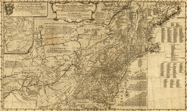
A map of the middle British colonies in North America. First published by Lewis Evans, of Philadelphia, in 1755; and since corrected and improved, as also extended, with the addition of New England, and bordering parts of Canada; from actual surveys now lying at the Board of Trade. By T. Pownall, mp. Engraved by Jas. Turner in Philadelphia.
Date
1776
Crédit
Photo12/Universal Images Group
Notre référence
UMG20A03_429
Model release
NA
Property release
NA
Licence
Droits gérés
Format disponible
160,2Mo (6,9Mo) / 82,3cm x 48,8cm / 9722 x 5759 (300dpi)