Sujet
British Colonies in the Southern US - 1776
Légende
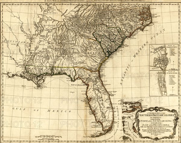
A general map of the southern British colonies in America, comprehending North and South Carolina, Georgia, East and West Florida, with the neighboring Indian countries, from the modern surveys of Engineer de Brahm, Capt. Collet, Mouzon, & others, and from the large hydrographical survey of the coasts of East and West Florida. By B. Romans, 1776.
Date
1776
Crédit
Photo12/Universal Images Group
Notre référence
UMG20A03_432
Model release
NA
Property release
NA
Licence
Droits gérés
Format disponible
129,0Mo (4,9Mo) / 63,9cm x 50,6cm / 7542 x 5978 (300dpi)