Sujet
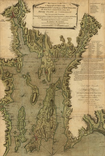
Narragansett Bay - 1777
Légende
A topographical chart of the bay of Narragansett in the province of New England, with all the isles contained therein, among which Rhode Island and Connecticut have been particularly surveyed, showing the true position & bearings of the banks, shoals, rocks &c. as likewise the soundings; To which have been added the several works & batteries raised by the Americans. Taken by order of the principal farmers on Rhode Island.
Date
1777
Crédit
Photo12/Universal Images Group
Notre référence
UMG20A03_448
Model release
NA
Property release
NA
Licence
Droits gérés
Format disponible
50,0Mo (6,0Mo) / 29,0cm x 43,2cm / 3428 x 5100 (300dpi)