Sujet
Topographical Map of the Hudson River - 1776 1777
Légende
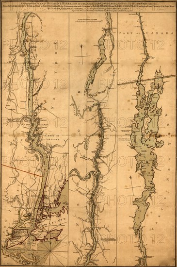
topographical map of Hudson River, with the channels depth of water, rocks, shoals &c. and the country adjacent, from Sandy-Hook, New York and bay to Fort Edward, also the communication with Canada by Lake George and Lake Champlain, as high as Fort Chambly on Sorel River. 1776.
Date
1777
Crédit
Photo12/Universal Images Group
Notre référence
UMG20A03_475
Model release
NA
Property release
NA
Licence
Droits gérés
Format disponible
49,4Mo (4,5Mo) / 28,7cm x 43,2cm / 3387 x 5100 (300dpi)