Sujet
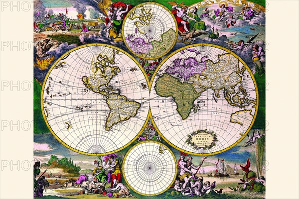
Stereographic Map of the World with Polar projections 1668
Légende
French cartographer, geographer, engraver and publisher Nicholas De Fer (1646-1720) took over the business begun by his father Antoine De Fer. Nicholas was a prolific producer of over 600 sheet maps, wall maps and atlases. His maps were prized for their decorative qualities rather than the accuracy of their geography. None the less, his reputation grew culminating in his appointment as Geographer to the King. Among his works are several atlases: France Triomphante in 1693, Forces de L’Europe 1696, Atlas Curieux 1705 and Atlas Royal.
Crédit
Photo12/Universal Images Group
Notre référence
UMG20A04_096
Model release
NA
Property release
NA
Licence
Droits gérés
Format disponible
31,6Mo (10,9Mo) / 34,4cm x 23,0cm / 4068 x 2712 (300dpi)