Sujet
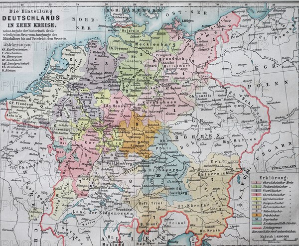
Historic map dividing Germany into ten districts in the 16th century
Légende
Historic map dividing Germany into ten districts in the 16th century, Imperial Circle / Historische Landkarte, die Einteilung Deutschland in zehn Kreise im 16. Jahrhundert, Reichskreise.
Crédit
Photo12/UIG/Bildagentur-online
Notre référence
UMG20B45_493
Licence
Droits gérés
Format disponible
29,5Mo (2,6Mo) / 29,9cm x 24,7cm / 3536 x 2912 (300dpi)