Sujet
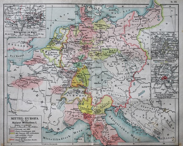
Historical map of central Europe from the time of emperor Wilhelm I. / Historische Landkarte von Mitteleuropa zur Zeit von Kaiser Wilhelm I.
Légende
Historical map of central Europe from the time of emperor Wilhelm I. / Historische Landkarte von Mitteleuropa zur Zeit von Kaiser Wilhelm I..
Crédit
Photo12/UIG/Bildagentur-online
Notre référence
UMG20B46_060
Licence
Droits gérés
Format disponible
29,6Mo (2,6Mo) / 30,5cm x 24,3cm / 3608 x 2872 (300dpi)