Sujet
Napoleonic map of Hohenlinden battlefield.
Légende
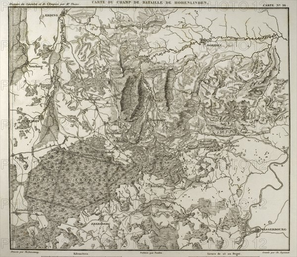
Napoleonic map. Hohenlinden battlefield map. Battle of Hohenlinden (3rd December, 1800), during the French Revolutionary Wars. Victory of the French troops, under Jean Victor Marie Moreau, against the Austrians and Bavarians led by Archduke John of Austria. Atlas de l'Histoire du Consulat et de l'Empire. History of the Consulate and the Empire of France under Napoleon by Marie Joseph Louis Adolphe Thiers (1797-1877). Drawings by Dufour and engravings by Dyonnet. Edited in Paris, 1864.
Date
1864
Crédit
Photo12/UIG/PHAS
Notre référence
UMG21A15_002
Licence
Droits gérés
Format disponible
44,9Mo (2,6Mo) / 36,0cm x 31,2cm / 4252 x 3688 (300dpi)