Sujet
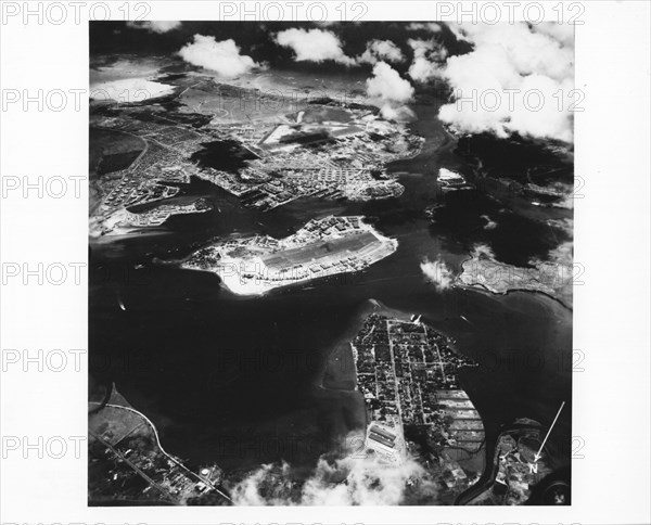
Aerial photo of Pearl Harbor Showing Landmarks
Légende
Aerial View of Pearl Harbor, Oahu, T.H., May 21, 1942. Lower right is Pearl City, Peninsula, lower left corner is Aiea Area, upper left corner is Naval Supply Depot, Upper Tank Farm, Navy Yard, Hickam Field in center background. Right corner is Iroquois Point, right center Waipio Peninsula. Photo by US Navy
United States
Date
21 mai 1942
Crédit
Photo12/Universal Images Group/GG Vintage Images
Notre référence
UMG22A00_249
Model release
Non
Property release
NA
Licence
Droits gérés
Format disponible
53,2Mo (1,2Mo) / 40,6cm x 32,8cm / 4800 x 3875 (300dpi)