Sujet
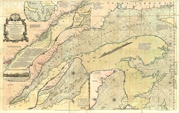
Vintage Maps / Antique Maps - An exact chart of the river St. Laurence, from Fort Frontenac to the island of Anticosti ca. 1771
Légende
Vintage Maps / Antique Maps - An exact chart of the river St. Laurence, from Fort Frontenac to the island of Anticosti ca. 1771.
Crédit
Photo12/Universal Images Group/HUM Images
Notre référence
UMG22A29_294
Model release
Non
Property release
Non
Licence
Droits gérés
Format disponible
14,9Mo (1,8Mo) / 24,3cm x 15,4cm / 2871 x 1814 (300dpi)