Sujet
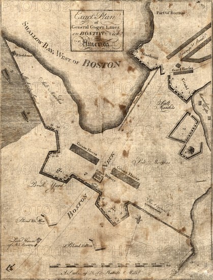
Vintage Maps / Antique Maps - Exact plan of General Gage's lines on Boston Neck in America ca. 1775?
Légende
Vintage Maps / Antique Maps - Exact plan of General Gage's lines on Boston Neck in America ca. 1775?.
Crédit
Photo12/Universal Images Group/HUM Images
Notre référence
UMG22A29_485
Model release
Non
Property release
Non
Licence
Droits gérés
Format disponible
18,3Mo (1,7Mo) / 18,7cm x 24,5cm / 2207 x 2894 (300dpi)