Sujet
San Francisco and Bay Area, CA seen from space
Légende
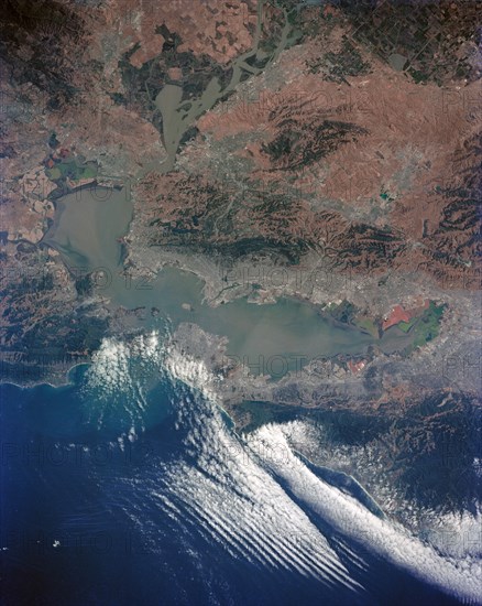
(5-14 June 1991) --- Although clouds obscure part of the city of San Francisco and the mouth of San Francisco Bay, development and physiographic features in the immediate vicinity of the bay are well displayed. The photograph clearly shows the eastern part of the city, including the Embarcadero, the Bay Bridge, which was damaged in the 1989 earthquake, and Candlestick Park, San Mateo, and Dumbarton Bridges, cross the southern portion of the bay. Vari-colored salt ponds also rim the southern Bay near Moffett Field. Highway 280 runs along the San Andreas fault south of the city. On the eastern margin of the bay are Berkeley the Sacramento River and the Haywood and Calaveras faults.
Info+
.
Crédit
Photo12/Universal Images Group
Notre référence
UMG22A40_269
Licence
Droits gérés
Format disponible
156,1Mo (10,1Mo) / 55,8cm x 70,0cm / 6596 x 8272 (300dpi)