Sujet
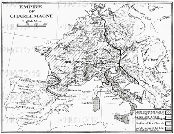
Map of France showing the Empire of Charlemagne.
Légende
Map of France showing the Empire of Charlemagne, 9th century. From France, Mediaeval and Modern A History, published 1918.
Date
1918
Crédit
Photo12/UIG/Universal History Archive
Notre référence
UMG23A58_413
Model release
Non
Property release
Non
Licence
Droits gérés
Format disponible
50,1Mo (1,8Mo) / 40,4cm x 31,1cm / 4770 x 3671 (300dpi)