Sujet
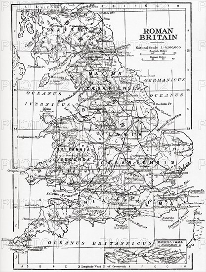
Map of Roman Britain showing the area of the island of Great Britain that was governed by the Roman Empire.
Légende
Map of Roman Britain showing the area of the island of Great Britain that was governed by the Roman Empire, from 43 to 410 AD. From Hutchinson's History of the Nations, published 1915.
Date
1915
Crédit
Photo12/UIG/Universal History Archive
Notre référence
UMG23A58_459
Model release
Non
Property release
Non
Licence
Droits gérés
Format disponible
50,5Mo (3,5Mo) / 31,0cm x 40,8cm / 3661 x 4819 (300dpi)