Sujet
Charleston Harbor 1861
Légende
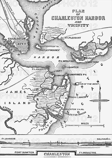
The map shows the layout of Charles Harbor in South Carolina in January of 1861. When South Carolina seceded from the Union in December of 1860, it demanded control of all Federal property, including Fort Sumter and Fort Moultrie, both shown on the map. When the officers in charge of the forts refused, the Confederates attacked on April 12, 1861.
Crédit
Photo12/Universal Images Group
Notre référence
UMG24A35_098
Licence
Droits gérés
Format disponible
51,7Mo (2,9Mo) / 30,3cm x 42,7cm / 3582 x 5040 (300dpi)