Légende
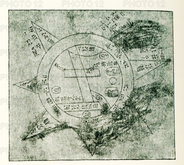
This Babylonian/Chaldaean map of the world was drawn by the French artist Henri Faucher-Gudin from a sketch by Peiser for a book on ancient Egypt by Gaston Maspero. This map is most often dated to the sixth century B.C. and is often referred to as Imago Mundi (Latin for: image of the world). It shows Babylon on the Euphrates River, surrounded by a circular landmass that is Assyria, present-day Armenia, and several cities. All is surrounded by a a waterway known as Oceanus, with seven islands arranged around it that serve to form a seven-pointed star. The text notes seven outer regions beyond Oceanus.
Crédit
Photo12/Universal Images Group/Ivy Close Images
Notre référence
UMG25A01_182
Licence
Droits gérés
Format disponible
52,1Mo (2,2Mo) / 38,1cm x 34,3cm / 4500 x 4047 (300dpi)