Légende
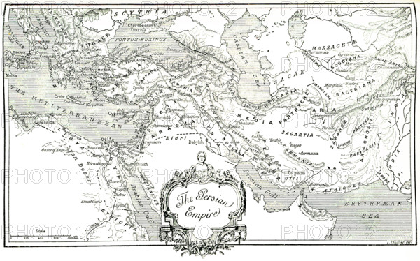
This map, which dates to 1903, delineates the ancient Persian Empire.The Persian Empire is the name given to a series of dynasties centered in modern-day Iran that spanned several centuries. The first Persian Empire, founded by Cyrus the Great around 550 B.C., became one of the largest empires in history, stretching from Europe’s Balkan Peninsula in the West to India’s Indus Valley in the East (as seen here). This Iron Age dynasty, sometimes called the Achaemenid Empire, was a global hub of culture, religion, science, art and technology for more than 200 years before it fell to the invading armies of Alexander the Great.
Crédit
Photo12/Universal Images Group/Ivy Close Images
Notre référence
UMG25A01_210
Licence
Droits gérés
Format disponible
53,9Mo (3,2Mo) / 46,5cm x 29,0cm / 5490 x 3431 (300dpi)