Légende
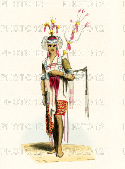
This 1840s illustration shows a herald from Timor. Timor is an island at the southern end of Maritime Southeast Asia, in the north of the Timor Sea. The island is divided between the sovereign states of East Timor on the eastern part and Indonesia on the western part. The Indonesian part, also known as West Timor, constitutes part of the province of East Nusa Tenggara. Timor is part of the area of the world known as Oceania. Oceania is a geographic region that includes Australasia, Melanesia, Micronesia and Polynesia. Spanning the Eastern and Western Hemispheres, Oceania has a land area of 8,525,989 square kilometers.
Crédit
Photo12/Universal Images Group/Ivy Close Images
Notre référence
UMG25A05_035
Licence
Droits gérés
Format disponible
53,4Mo (1,7Mo) / 31,5cm x 42,5cm / 3720 x 5020 (300dpi)