Légende
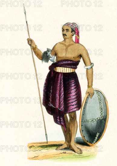
This 1840s illustration shows a warrior from the island of Savu. Savu is the largest of a group of three islands, situated midway between Sumba and Rote, west of Timor, in Indonesia's eastern province, East Nusa Tenggara. Ferries connect the islands to Waingapu on Sumba, Ende on Flores, and Kupang in West Timor. Savu is part of the area of the world known as Oceania. Oceania is a geographic region that includes Australasia, Melanesia, Micronesia and Polynesia. Spanning the Eastern and Western Hemispheres, Oceania has a land area of 8,525,989 square kilometers.
Crédit
Photo12/Universal Images Group/Ivy Close Images
Notre référence
UMG25A05_046
Licence
Droits gérés
Format disponible
52,5Mo (1,9Mo) / 30,5cm x 43,2cm / 3597 x 5100 (300dpi)