253 résultats pour : miles
- Page
-
- sur
- 3
Connectez-vous pour plus de résultats
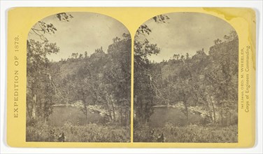
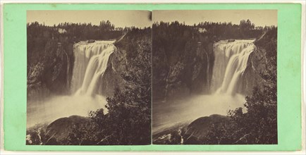
LZT20A34_364
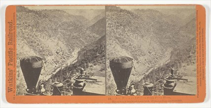
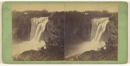
Am. River and Canon from Cape Horn, River below Ra...
LZT20A17_426
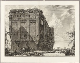
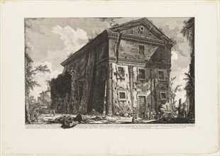
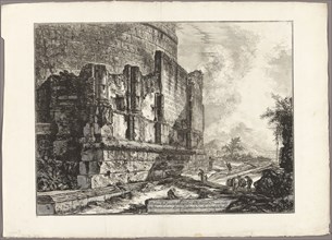
Ancient temple commonly called the Temple of Healt...
LZT20A22_462
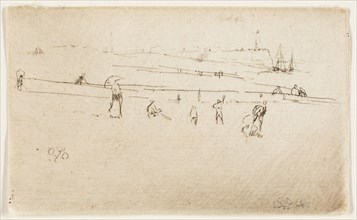
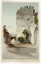
Dieppe, 1885, James McNeill Whistler, American, 18...
LZT20A17_414
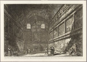
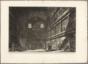
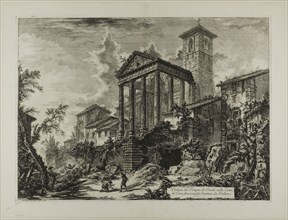
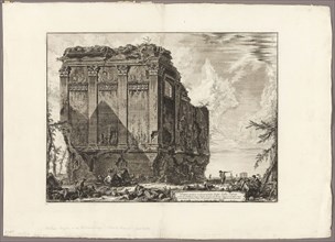
Interior view of the ancient Temple of Bacchus, no...
LZT20A17_424
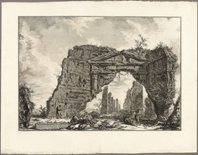
Remains of a covered portico, or a cryptoporticus,...
LZT20A01_271
View of the Temple of Bacchus, now the church of S...
LZT20A37_486
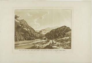
View of the River Dee 3 Miles Short of Bala, with ...
LZT20A32_470
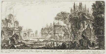
Part of the ancient Appian Way about three miles o...
LZT20A01_272
Interior view of the ancient Temple of Bacchus, no...
LZT20A37_373
Conway Castle, 1849, Thomas Miles Richardson, the ...
LZT20A28_148
Cooley’s Ranch, 10 miles east of Camp Apache, Ariz...
LZT20A22_466
Colinet’s Journey: Milestone Marked LXII Miles to ...

LZT20A40_427
Young Girl in an Orchard with a Basket of Fruit, c...
LZT20A31_257
Bowl with Black Interlocking Lattice on Interior, ...
LZT20A17_428
View of the Temple of Hercules at Cori, ten miles ...
LZT20A32_072
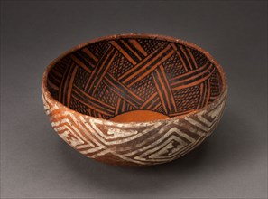
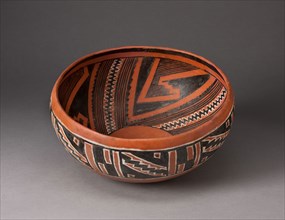
Polychrome Bowl with Geometric Star Motif on Inter...
![View of the Ponte Molle [or Milvian Bridge] over the Tiber two miles outside Rome, from Views of](https://lres.photo12.com/th/t-lzt20a01_269.jpg)
LZT20A01_269
View of the Ponte Molle [or Milvian Bridge] over t...
LZT20A28_146
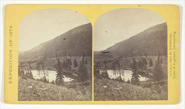
Apache Lake, Summit of Sierra Blanca Mountains, ab...
LZT20A32_061
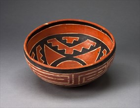
Bowl with Geometric Black-and-White Motifs on Inte...
LZT20A28_152
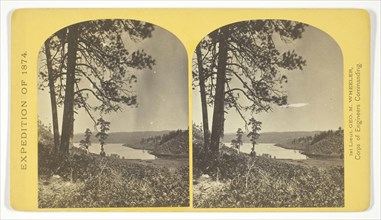
Beaver Lake, Conejos Cañon, Colorado, 9.000 feet a...
LZT20A40_263
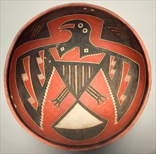
Bowl Depicting a Bird with Outstretched Wings, 130...
LZT20A01_264
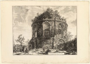
View of the So-Called Tempio della Tosse (Temple o...
LZT20A01_279
View of the Remains of the Tomb of the Plautii on ...
LZT20A28_162
Lagunas Caballo, or Horse Lakes, 14 miles, N. W. f...
LZT20A01_278
Ancient temple commonly called the Temple of Healt...

LZT20A13_176
Travelers stopping at a mile post, c. 1805/06, Kat...
LZT20A28_161
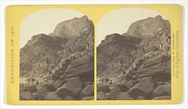
View of Grand Cañon walls, near mouth of Diamond R...
LZT20A28_142
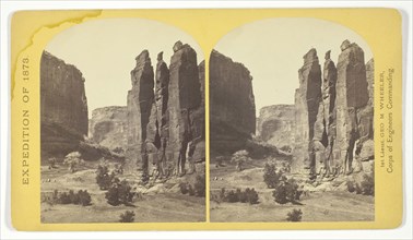
Camp Beauty, Canñon de Chelle, walls 1.200 feet hi...
LZT20A28_160
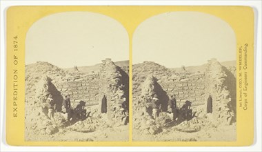
Characteristic ruin, of the Pueblo San Juan, New M...
LZT19B48_037
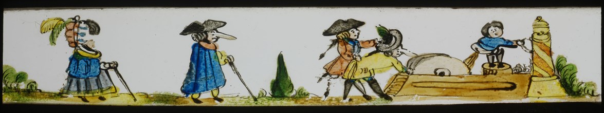
Hand-painted lantern plate with figures with long ...
LZT19B49_166
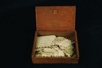
Geography puzzle in coffin: map with the Netherlan...

LZT19B10_267
man with full beard, grayish at the bottom, in vig...
LZT19B24_360
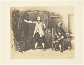
Miles Standish and John Alden; Mathew B. Brady, Am...
LZT19B30_132
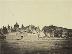
Villa de Guadalupe, Views of Mexico City and envir...
LZT19B35_002
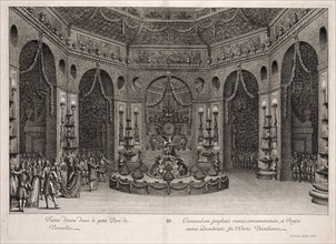
Festin donné dans le petit parc de Versailles, Rel...
LZT19B04_376
View looking down the Ausable River a distance of ...
LZT19B05_011
Montmorency Falls, 7 miles below Quebec; L.P. Vall...
LZT19B06_105
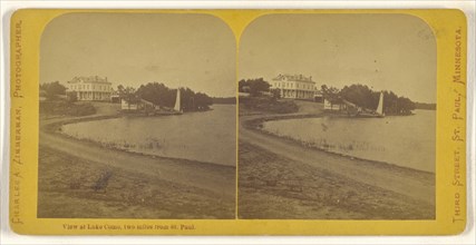
View at Lake Como, two miles from St. Paul; Charle...
LZT19A98_196
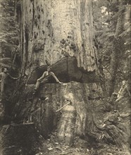
Felling a Cedar Tree, 30 Miles East of Seattle, 76...

LZT19B01_208
John Philips Miles; Julia Margaret Cameron, Britis...

LZT19B15_402
Major Miles; British, active India about 1843; Ind...

LZT19B22_433
Miles White; Bendann Brothers, American, active 18...
LZT19B14_358
Monterey, California. Moss Avenue, 18 Mile Drive; ...
LZT19B04_491
Montmorency Falls, 7 miles below Quebec; L.P. Vall...
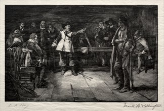
LZT19A42_297
Miles Standish's Challenge, 1887. Frank H. Welling...
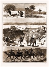
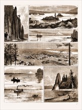
LZT16A09_244
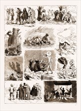
THE REBELLION IN SUDAN, 1883: 1. On the Road to Be...
LZT16A09_021
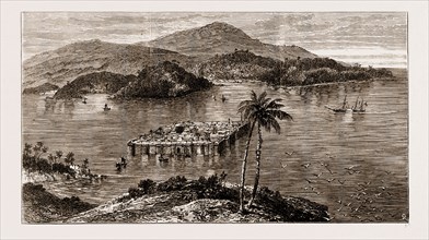
THE RESTORATION OF CETEWAYO: 1. Emangete, Chief Du...
LZT16A09_232
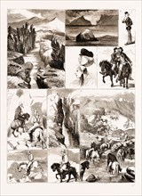
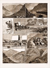
AN ASCENT OF BEN MACDHUI, 1883: 1. We Arose Punctu...
LZT16A09_426
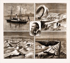
THE NORDENSKJOLD GREENLAND EXPEDITION, 1883: 1. Th...
LZT16A07_486
ICELAND: 1. The Almanna-Gja Fissure, Four Miles in...
LZT16A08_401
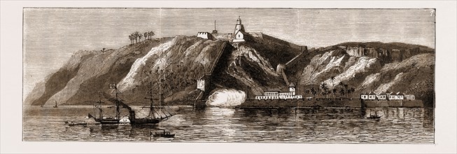
1. The Indian Government steamer May Frere, with t...
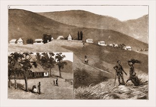
LZT16A09_402
THE HEX RIVER RAILWAY, CAPE COLONY, SOUTH AFRICA, ...
LZT16A08_400
1. The Indian Government steamer May Frere, with t...
LZT16A09_335
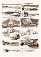
SKETCHES ON THE MEUSE BETWEEN NAMUR AND GIVET, 188...

LZT16A06_106
Lancaster, Pennsylvania - Housing. Farm on Lititz ...
LZT16A10_044
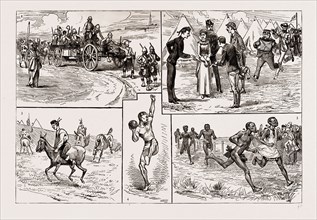
SPORTS AT FORT CURTIS, ETSHOWE, ZULULAND, 1886: 1....

LZT16A11_005
"HOW WE SAVED MAcDOUGALL'S LIFE": A STORY OF AN IN...
LZT16A10_006
VIEWS ON THE NORTHERN PACIFIC RAILWAY, U.S.A., U.S...
LZT16A09_066
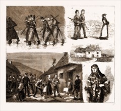
FLY LEAVES FROM THE POCKET-BOOK OF A SOLDIER IN IR...
LZT16A27_338
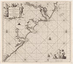
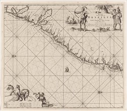
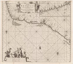
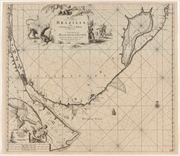
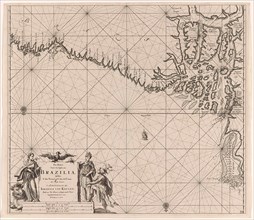
Sea chart of part of the coast of Brazil, Jan Luyk...
LZT16A27_412
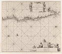
Sea chart of part of the coast of the Kola peninsu...
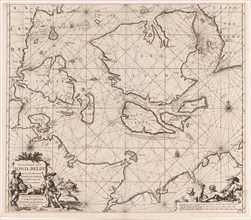
LZT16A27_430
Sea chart of the Danish Islands, part of the coast...
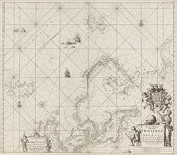
LZT16A27_439
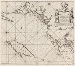
Sea chart of the Baltic and North Sea, Jan Luyken,...
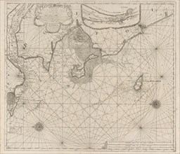
LZT16A27_385
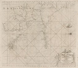
Sea chart of part of the coast of Brittany, Anonym...
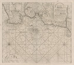
LZT16A27_394
Sea chart of part of the south coast of Brittany, ...
LZT16A27_403
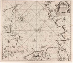
Sea chart of the coast of Ireland, Scotland, Engla...
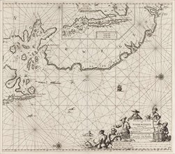
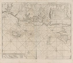
LZT16A27_421
Sea chart of the southern part of the Baltic Sea, ...
LZT16A27_448
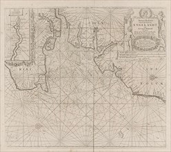
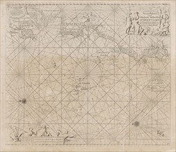
Sea chart of the coasts of England, Scotland and I...
LZT16A27_339
Sea chart of part of the east coast of Brazil, pri...
LZT16A27_413
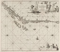
Sea chart of part of the coast of Finnmark, Jan Lu...
LZT16A27_431
Sea chart of Denmark in the Skagerrak and Kattegat...
LZT16A27_348
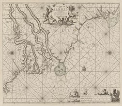
Sea chart of the coast of Gambia and part of the c...
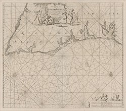
LZT16A27_384
Sea map of part of the south coast of Portugal and...
LZT16A27_395
Map of the west coast of Brittany, Anonymous, Clae...
LZT16A27_420
Sea chart of the northwestern part of the Baltic S...
LZT16A27_449
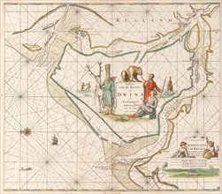
Sea chart of the Northern Dvina River, Jan Luyken,...
LZT16A27_340
Sea chart of the east coast of Brazil, Jan Luyken,...
LZT16A12_370
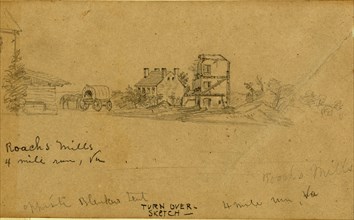
Roachs Mills. 4 mile run Va, 1861-1863, drawing, ...
LZT16A27_414
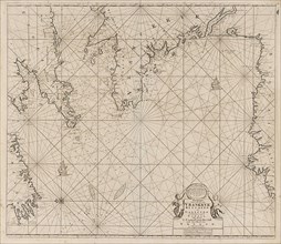
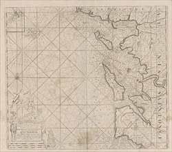
Sea chart of part of the Norwegian coast, Norway, ...
LZT16A27_441
Sea chart of part of the coast of Ireland, England...
LZT16A27_068
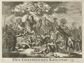
Christian Knight, upper, Jan Luyken, Johannes Boek...
LZT16A27_351
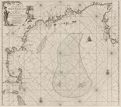
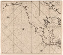
Sea chart of part of the east coast of the United ...
LZT16A27_383
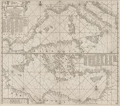
the Mediterranean Sea Map with over the western an...
LZT16A27_392
Sea chart of Saintonge and Aunis, Anonymous, Claes...
LZT16A27_405
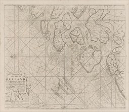
Sea chart of the Zeeland Islands and part of the N...
LZT16A27_419
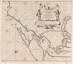
Map of the waters around Stockholm, Jan Luyken, Jo...
LZT16A27_428
Sea chart of part of the coast of Norway, print ma...
LZT16A27_450
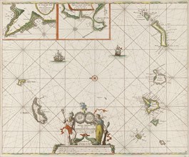
Sea chart of the Canary Islands, print maker: Jan ...
LZT16A27_341
Sea chart of a portion of the northeast coast of B...
LZT16A27_451
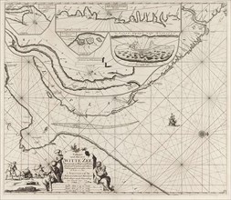
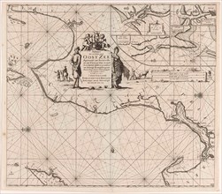
Sea chart of the Zuiderzee and the Wadden Sea, Jan...
LZT16A27_415
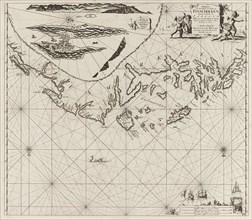
Sea chart of Northern part of Atlantic and Arctic ...
LZT16A27_440
Sea chart of the Strait of Gibraltar, Anonymous, J...
LZT16A27_350
Sea chart a part of the coast of northern Canada a...
LZT16A27_393
Sea chart of the coast of France between the islan...
LZT16A27_404
Sea chart of part of the east coast of England at ...
LZT16A27_418
Sea chart of a portion of the Baltic coast of Pola...
LZT16A27_335
Sea chart of part of the coast of Brazil, Uruguay ...
LZT16A27_342
Sea chart of part of the coast of Brazil with the ...
LZT16A27_353
Sea chart of part of the east coast of the United ...
LZT16A27_408
Sea chart of the Atlantic Ocean to the west coast ...
- Page
-
- sur
- 3