114 résultats pour : 16th century maps
- Page
-
- sur
- 2
Connectez-vous pour plus de résultats
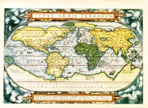
UMG25A06_184
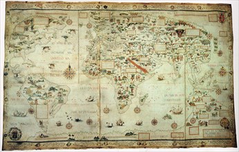
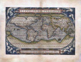
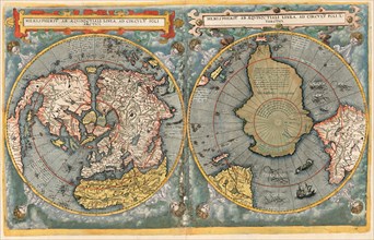
The text at the top of this world map by Abraham O...
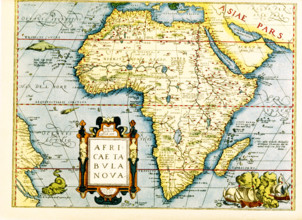
UMG25A06_178
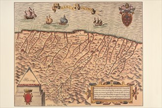
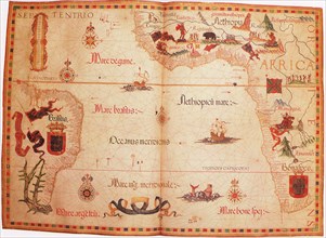
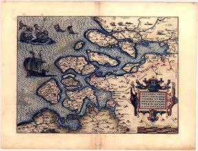
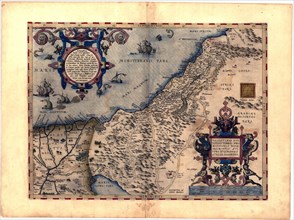
Map of Africa - the inset in lower left titles it:...
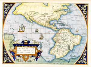
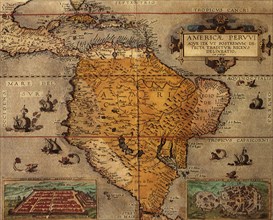
UMG25A06_179
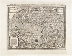
Abraham Ortelius's map of the Americas, Americae s...
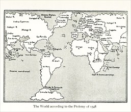
UMG25A01_160
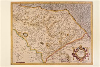
This map by Giacomo Gastaldi (c 1500 – c 1565) was...
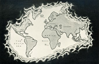
UMG24A07_006
This illustration dates to 1912 and is part of a s...
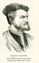
UMG24A07_002
This illustration of Jacques Cartier dates to 1912...
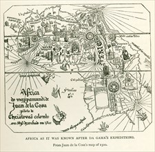
UMG24A06_497
This image shows Africa as it was known after DaGa...
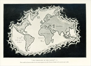
UMG24A07_005
This illustration dates to 1912 and is part of a s...
UMG23A66_398
Carte géographique du 16e siècle
UMG23A66_399
Carte géographique du 16e siècle

UMG23A61_161
The beheading of Cornelis de Hooghe.
UMG23A62_478
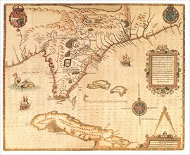
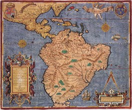
Map of North and South America.
UMG22A69_251
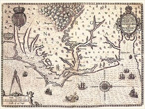
Americae pars, Nune Virginia dicta.
UMG22A67_399
Head of the World.
UMG22A69_242
The Maggiolo Map.
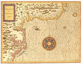
UMG22A69_254
Norumbega et Virginia.
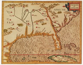
UMG22A69_253
Florida et Apalche.
UMG22A67_455
Map of South America.
UMG22A69_252
Floridae Americanae Provinciae Recens & exactissim...
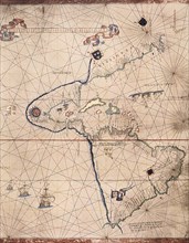
UMG22A69_162
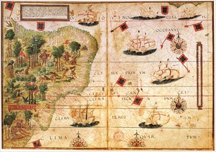
Chart of the South Atlantic.
UMG22A69_250
Tabu Nova Orbis.
UMG22A69_168
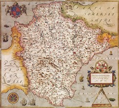
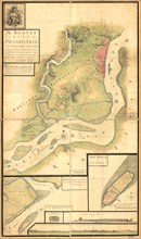
Map of Devonshire, England.
UMG22A69_160
Map of South America.
UMG22A67_388
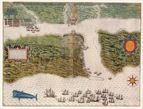
Attack on St. Augustine.
UMG22A69_164
Map of Brazil.
UMG22A69_165
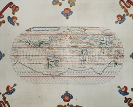
Map of the World.
UMG22A24_492
Abraham Ortelius - First World Atlas ca. 1570 - Ze...
UMG22A24_493
Abraham Ortelius - First World Atlas ca. 1570 - Th...
UMG22A24_494
Abraham Ortelius - First World Atlas ca. 1570 - Fr...
UMG22A32_143
Abraham Ortelius - First World Atlas ca. 1570 - An...
UMG22A24_485
Abraham Ortelius - First World Atlas ca. 1570 - Th...
UMG22A24_495
Abraham Ortelius - First World Atlas ca. 1570 - Av...
UMG22A32_142
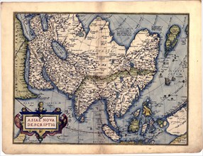
Abraham Ortelius - First World Atlas ca. 1570 - As...
UMG22A24_488
Abraham Ortelius - First World Atlas ca. 1570 - Bi...
UMG22A24_500
Abraham Ortelius - First World Atlas ca. 1570 - Rv...
UMG22A32_145
Abraham Ortelius - First World Atlas ca. 1570 - Ga...
UMG22A24_489
Abraham Ortelius - First World Atlas ca. 1570 - Ca...
UMG22A24_499
Abraham Ortelius - First World Atlas ca. 1570 - Si...
UMG22A32_144
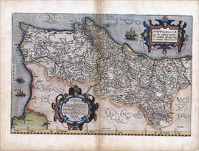
Abraham Ortelius - First World Atlas ca. 1570 - Po...
UMG22A24_490
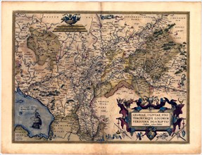
Abraham Ortelius - First World Atlas ca. 1570 - Ge...
UMG22A25_002
Abraham Ortelius - First World Atlas ca. 1570 - Na...
UMG22A32_147
Abraham Ortelius - First World Atlas ca. 1570 - Tr...
UMG22A24_491
Abraham Ortelius - First World Atlas ca. 1570 - Br...
UMG22A25_001
Abraham Ortelius - First World Atlas ca. 1570 - Pe...
UMG22A32_146
Abraham Ortelius - First World Atlas ca. 1570 - Sa...
UMG22A32_149
Abraham Ortelius - First World Atlas ca. 1570 - Pa...
UMG22A32_148
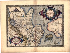
Abraham Ortelius - First World Atlas ca. 1570 - Ta...
UMG22A24_496
Abraham Ortelius - First World Atlas ca. 1570 - Ba...
UMG22A32_238
Abraham Ortelius - First World Atlas ca. 1570 - Gr...
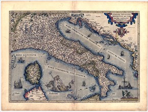
UMG22A24_497
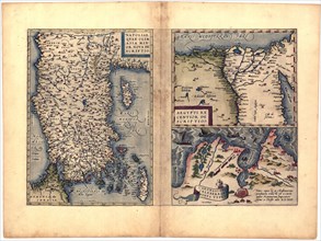
Abraham Ortelius - First World Atlas ca. 1570 - It...
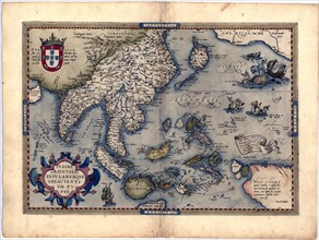
UMG22A25_072
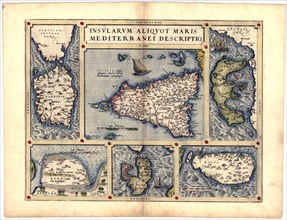
Abraham Ortelius - First World Atlas ca. 1570 - In...
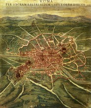
UMG22A26_052
Vintage Maps / Antique Maps - A survey of the city...
UMG22A22_220
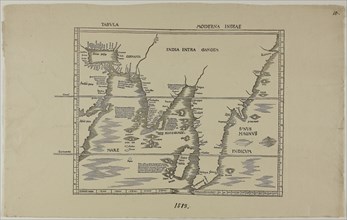
Tabula Moderna Indiae 1513
UMG22A03_311
Cornelis De Jodes verdenskart
UMG21A22_213
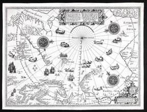
Barentskartet, 1598.
UMG21A17_119
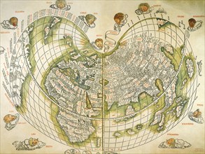
Map of the World 1511
UMG21A14_141
Map by Spanish marine and cartographer Juan de la ...
UMG21A06_220
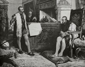
Emperor Charles V
UMG21A02_214
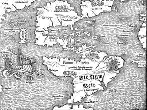
historical map with the view of America at the beg...
UMG20B38_345
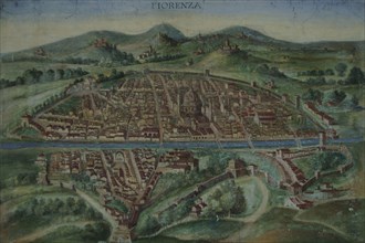
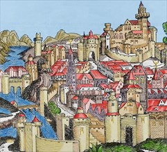
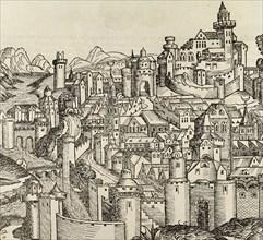
Florence. Map of the city in 16th century.
UMG20B38_193
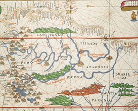
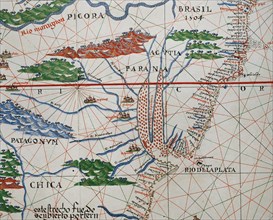
Amazon basin and two mouths.
UMG20B38_192
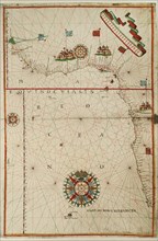
Portolan atlas.
UMG20B38_194
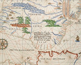
Strait of Magellan, Patagonia and Tierra de Fuego.
UMG20B38_187
Map of the Canary Islands and the west coast of Af...
UMG20B38_189
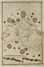
Western Mediterranean.
UMG20B38_188
West Coast of the African Continent.
UMG20B38_191
Portolan atlas.
UMG20B38_190
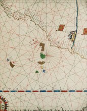
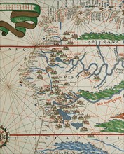
American west coast (Peru, Ecuador and Colombia).
UMG20B37_085
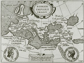
Romani Imperii Imago.

UMG20B40_212
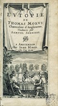
Utopia.
UMG20B40_200
Italy, Pisa.
UMG20B39_232
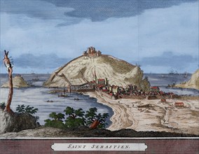
Spain. San Sebastian or Donostia. Santa Clara Isla...
UMG20B36_195
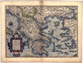
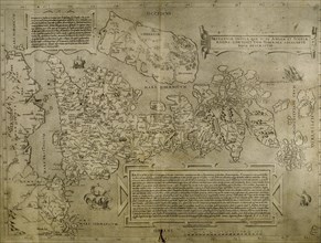
Italy. Cities of Mantua, Bologna, Venice, Modena, ...
UMG20B38_038
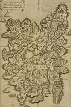
Map of Corsica. Italian engraving. 16th century.
UMG20B36_314
Pisa. Italy. Engraving.
UMG20B38_037
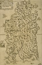
Map of Sardinia. Mediterranean Sea. Italian engrav...
UMG20B36_196
Map of the British Isles. 16th century. 1543
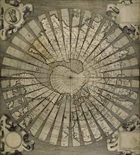
UMG20B36_199
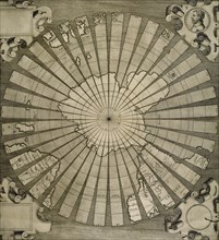
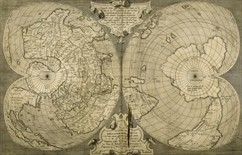
World map. South Pole. Map by Antonius Florianus. ...
UMG20B36_317
France. Lyon. Engraving.
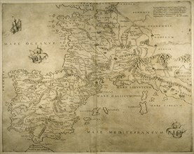
UMG20B36_200
Iberian Peninsula, France and northern Italy.
UMG20B38_040
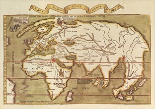
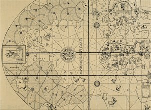
World map by Claudius Ptolemy (90-168). Engraving,...
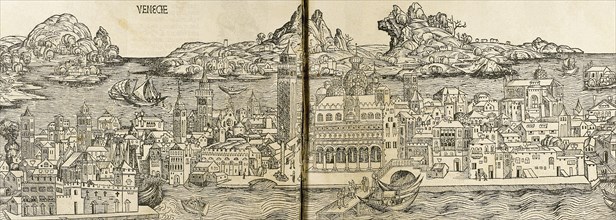
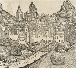
UMG20B36_290
Venice. Italy. Engraving.
UMG20B38_039
World map. Italian engraving. 16th century.
UMG20B38_136
Utopia.
UMG20B36_186
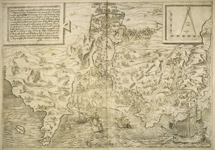
Map of the cities of North Africa. 16th century.
UMG20B36_187
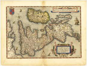
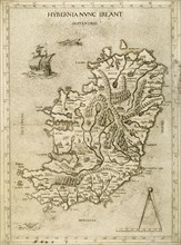
Hybernia Nunc Irlant. Ireland. Map.
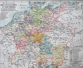
UMG20B45_493
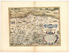
Historic map dividing Germany into ten districts i...
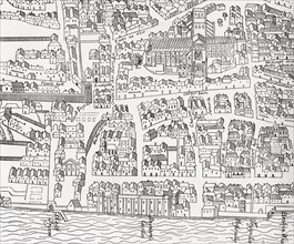
UMG20B27_067
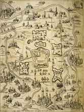
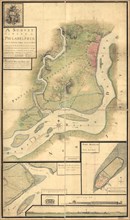
Plan of London around St
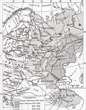
UMG20B19_451
Map of Russia in the 16th and 17th centuries
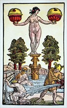
UMG20A34_199
Playing card by peter floetner
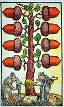
UMG20A34_264
Playing card
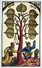
UMG20A34_265
Playing card
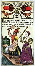
UMG20A34_201
Playing card of a viennese master
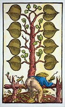
UMG20A34_200
Playing card by peter floetner
UMG20A00_034
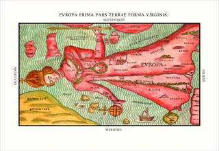
Europa Prima Pars 1580
UMG20A00_037
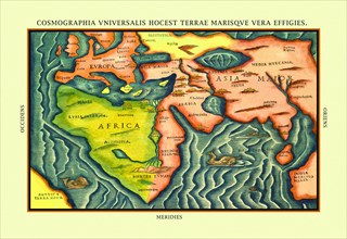
Cosmographia Universalis 1580
UMG20A03_482
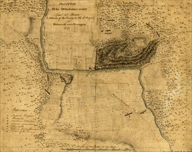
Walmscock near Bennington showing the attacks of t...
UMG20A04_084
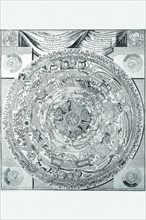
Celestial Map 1603
UMG20A04_104
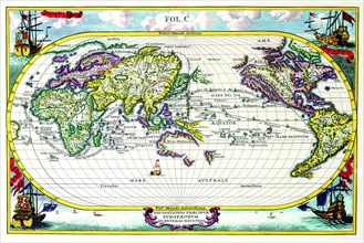
Navigationes Precipae Europorum ad Exteras Natione...
UMG20A03_473
Fort Mifflin - 1777
- Page
-
- sur
- 2