28 résultats pour : 1800s maps
- Page
-
- sur
- 1
Connectez-vous pour plus de résultats
UMG25A06_170
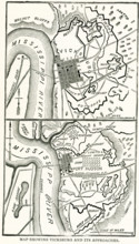
This map dating to late 1800s shows Vicksburg and ...
UMG25A01_402
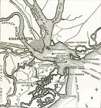
American civil war, us civil war, Charleston harbo...

UMG25A01_162
This map shows the exploration and partition of Af...
UMG25A01_401
Two forts stand at the entrance of Charleston Harb...

UMG22A54_020
Géographie

UMG22A55_075
Géographie
UMG22A56_119
Géographie

UMG22A54_089
Illustration

UMG22A55_067
Géographie

UMG22A54_499
Géographie
UMG22A57_424
Géographie
UMG22A54_081
Illustration

UMG22A27_082
Young America hams and breakfast bacon, E.S. Baker...
UMG22A23_357
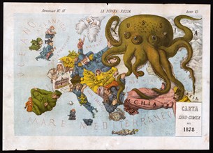
La piovra Russa (Italian political cartoon by Gros...
UMG22A25_363
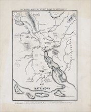
The novel & interesting game of matrimony. Map of ...
UMG22A19_094
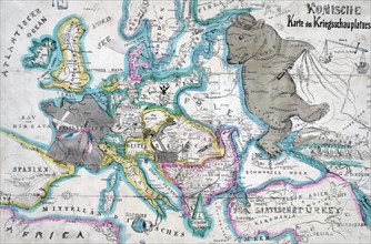
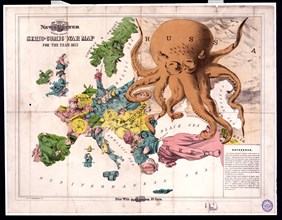
Comic war map for the year 1877
UMG22A06_362
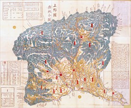
Geographical map of Kozuke Province
UMG22A06_490
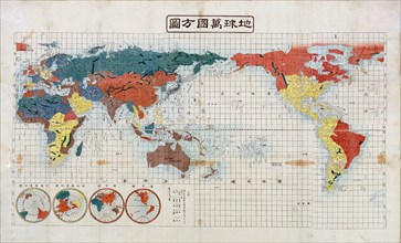
Square map of all the countries on the globe

UMG22A07_155
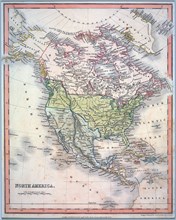
Hand coloured map of North America ca. 1836
UMG22A05_455
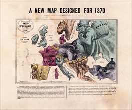
A new map designed for 1870 Europe
UMG22A06_063
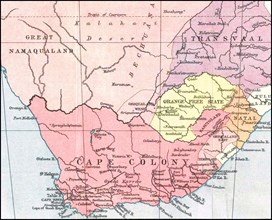
South Africa History
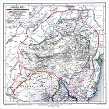
UMG22A06_061
South Africa History
UMG22A06_480
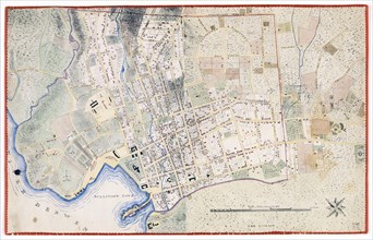
Hobart Town Map
UMG22A06_349
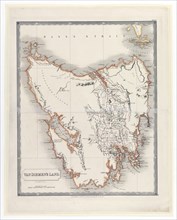
Van Diemen's Land Map ca. 1828

UMG22A05_426
Antique map

UMG22A06_288
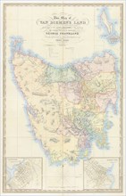
Map of Van Diemen's Land
UMG22A04_187
Reichborns kart over Christiania
UMG21A22_214