55 résultats pour : early cartography
- Page
-
- sur
- 1
Connectez-vous pour plus de résultats
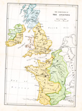
UMG25A05_102
This map shows the dominions of the Angevins in Br...
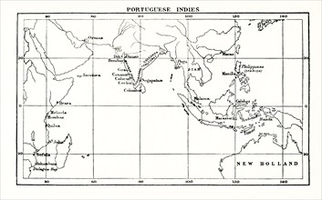
UMG25A01_169
This map shows the Portuguese exploits in the Indi...
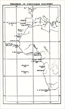
UMG25A01_168
This map shows the progress of Portuguese discover...
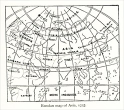
UMG25A01_161
This Russian map shows how they pictured Asia in ...
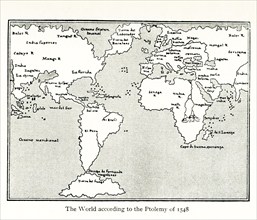
UMG25A01_160
This map by Giacomo Gastaldi (c 1500 – c 1565) was...
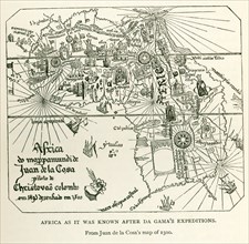
UMG24A06_497
This image shows Africa as it was known after DaGa...
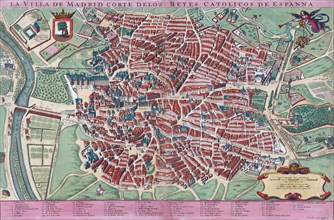
UMG23A61_201
Anonymous map of Madrid dating from late 17th or e...
UMG22A04_187
Reichborns kart over Christiania
UMG22A03_495
Geelkercks kart over Christiania
UMG22A03_072
Linschotens kart over Vardø - Cartographer Jan Huy...
UMG22A03_311
Cornelis De Jodes verdenskart
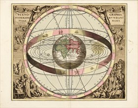
UMG21A22_217
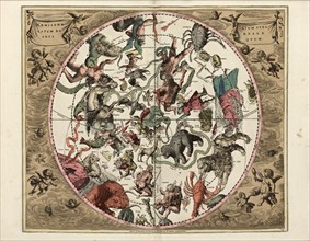
Cellarius' Scenographia Systematis Mundani Ptolema...
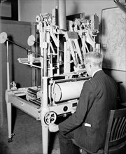
UMG21A21_004
A worker using a planimetor, which measures the ex...
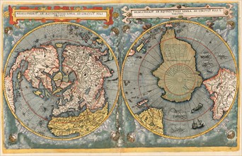
UMG21A22_218
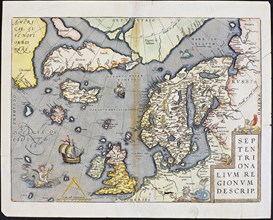
Abraham Ortelius nordenkart, 1601 - Map of Norther...
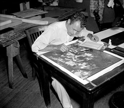
UMG21A21_003
A worker is shown making a stereoscopic examinatio...
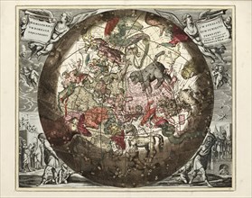
UMG21A22_215
Cellarius' Hæmisphærium Stellatum Boreale Antiqvum...
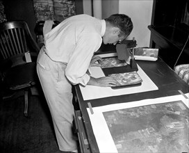
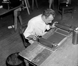
UMG21A21_002
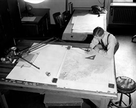
Map maker fitting together photos for the final ma...

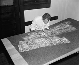
UMG21A21_279
Geological Survey. Washington, D.C., March 13. Alb...
UMG21A22_216
Cellarius' Hæmisphærium Stellatvm Boreale cvm Subi...
UMG21A21_001
A worker is shown inspecting a roll of film for fl...
UMG21A21_280
Geological Survey, Dept. Interior. Washington, D.C...
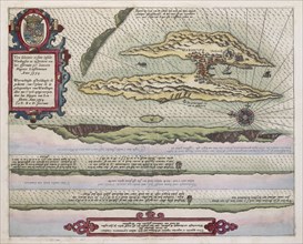
UMG21A22_213
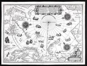
Barentskartet, 1598.
UMG21A22_214
Cartographer Vibe og Irgens - Vibe og Irgens kart ...
UMG21A22_026
Map-making Division of Coast & Geodetic Survey, De...

UMG21A22_027
Map-making Division of Coast & Geodetic Survey, De...
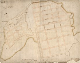
UMG20A01_059
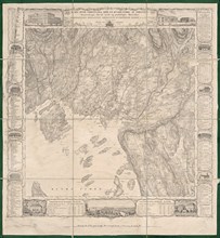
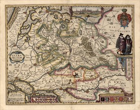
The area around Utrecht 1622
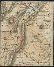
UMG20A02_386
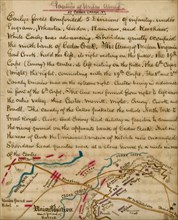
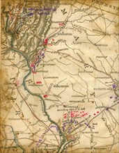
Chancellorsville, Va.. Position of armies 3rd May ...
UMG20A02_417
Union Army at Cedar Creek 1864
UMG20A04_114
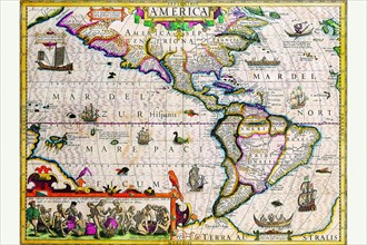
The Americas 1619
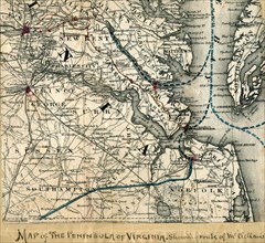
UMG20A03_007
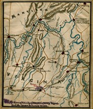
Harper's Ferry, Virginia, and the upper Potomac Ri...
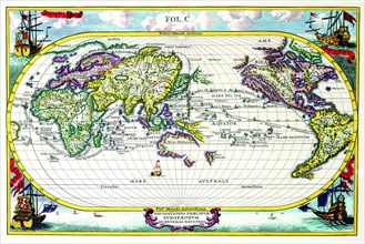
UMG20A04_104
Navigationes Precipae Europorum ad Exteras Natione...
UMG20A04_117
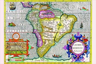
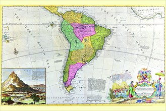
South America 1630
UMG20A02_418
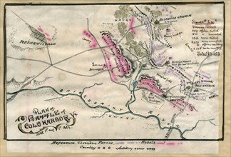
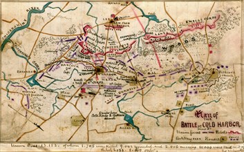
Battle of Cold Harbor, Va. : June 1st and 3rd 1864...
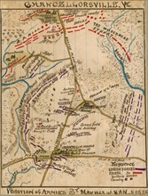
UMG20A03_006
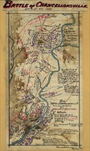
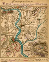
Battle of Chancellorsville, Va., including operati...
UMG20A04_126
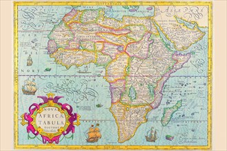
Africa 1610
UMG20A02_293
Battle of Antietam 1864
UMG20A02_390
Battle of Kelly's Ford, Va.. Plan of position of U...
UMG20A02_491
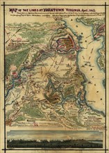
Yorktown Siege 1862
UMG20A01_314
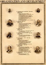
Organization & Development of the United States 18...
UMG20A02_364
Battle of Cold Harbor 1864
UMG20A02_490
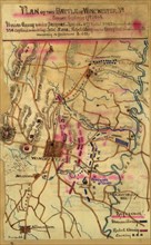
Battle of Winchester, Va. Fought September 19th, 1...
UMG20A04_107
Antique Map of South America 1715
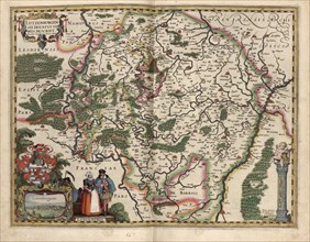
UMG20A01_048
Map of Luxembourg 1622
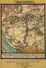
UMG20A02_499
Rebel Plan to Attack Washington, DC 1864
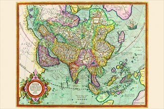
UMG20A04_132
Asia 1620
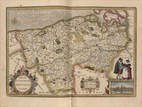
UMG20A01_047
Flanders, Belgium Map 1622
UMG20A02_389
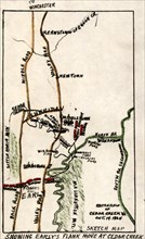
Battlefield of Cedar Creek, Va., 1864
UMG20A03_178
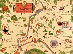
Hartford, Connecticut Historical
UMG20A02_354
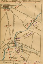
Battle of Monocacy, Maryland, July 9th, 1864. 1864
UMG20A02_355
Battle for Fort Wagner 1863
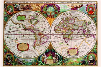
UMG20A04_099
Stereographic Map of the World 1630
UMG20A02_307
McClellan's Army toward Richmond 1862
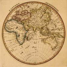
UMG20A01_076
Eastern Hemisphere 1817
UMG20A02_306
Shenandoah Campaign 1864
UMG20A00_310