421 résultats pour : world map
- Page
-
- sur
- 5
Connectez-vous pour plus de résultats
UMG25A05_353
This illustration dates to the 1870s and shows a t...
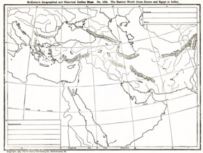
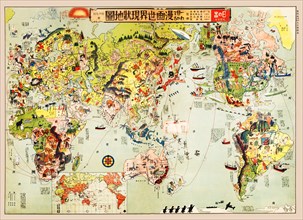
UMG25A06_183
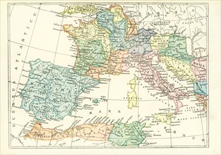
This geographical and historical outline map shows...
UMG25A06_181
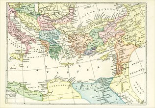
This geogrpahical and historical outline maps show...
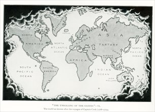
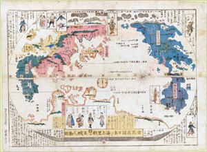
UMG25A05_438
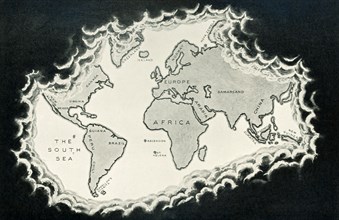
The image dates to the early 1920s. Around the wor...
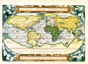
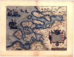
UMG25A06_184
The text at the top of this world map by Abraham O...
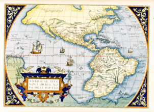
UMG25A06_179
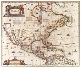
Abraham Ortelius's map of the Americas, Americae s...
UMG25A06_180
This geographical and historical outline map shows...
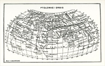
UMG25A01_164
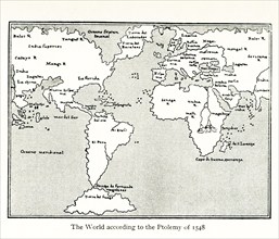
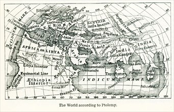
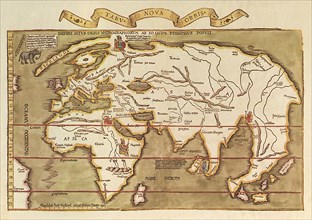
This map shows the world according to Ptolemy. The...
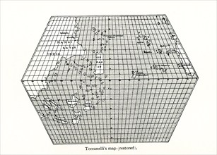
UMG25A01_156
Toscanelli’s Map (Restored). Toscanelli (1397 –14...
UMG25A01_182
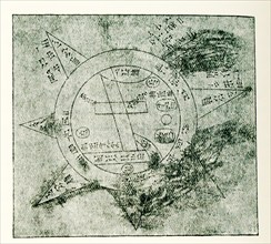
This Babylonian/Chaldaean map of the world was dra...
UMG25A01_402
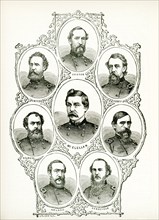
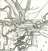
American civil war, us civil war, Charleston harbo...
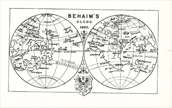
UMG25A01_157
This illustration shows Behaim's globe in 1492. Ma...
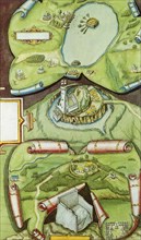
UMG25A01_401
Two forts stand at the entrance of Charleston Harb...
UMG25A01_160
This map by Giacomo Gastaldi (c 1500 – c 1565) was...
UMG25A00_453
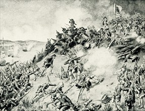
On June 17, 1775, early in the Revolutionary War (...
UMG25A01_202
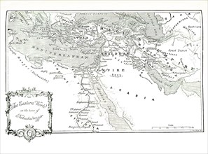
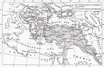
This 1903 illustration shows a map of the eastern ...
UMG24A34_387
The caption for this map from The Travels of Marco...
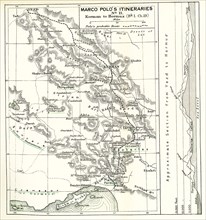
UMG24A34_384
The caption for this map from The Travels of Marco...
UMG24A07_006
This illustration dates to 1912 and is part of a s...
UMG24A06_490
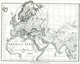
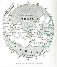
This map shows the world as it was known to the an...
UMG24A06_489
This image shows a map of the world ""according to...
UMG24A06_491
Pictured here is the world according to Ptolemy, a...
UMG24A06_497
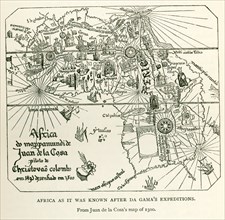
This image shows Africa as it was known after DaGa...
UMG24A07_005
This illustration dates to 1912 and is part of a s...
UMG24A07_010
This illustration dates to 1912 and is part of a s...
UMG24A06_475
This map dates to 1897 and shows the western Provi...
UMG24A06_476
This map dates to 1897 and shows the western Provi...
UMG23A62_334
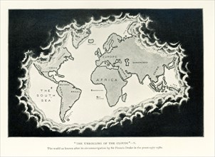
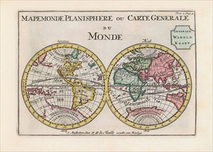
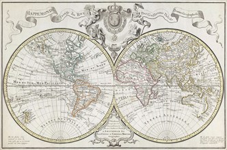
World map dating from the late 17th or early 18th ...
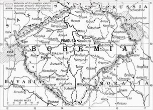
UMG23A59_110
Map of Bohemia at the outbreak of WWI.
UMG23A58_373
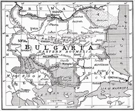
Map of Bulgaria at the outbreak of WWI.
UMG23A61_061
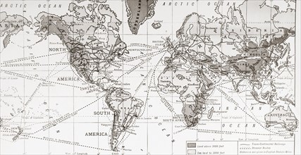
Physical map of the world.
UMG23A58_371
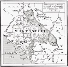
Map of Montenegro at the outbreak of WWI.
UMG23A58_312
Map of Turkey at the outbreak of WWI.
UMG23A58_351
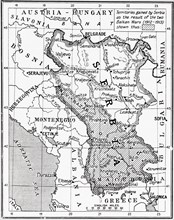
Map of Serbia at the start of WWI.
UMG23A61_164
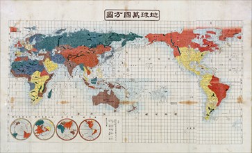
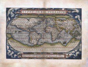
World Map.
UMG23A39_254
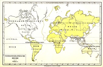
Animal Geographic World Map
UMG23A00_015
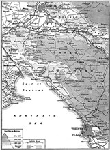
Map of Carso Battlefield.
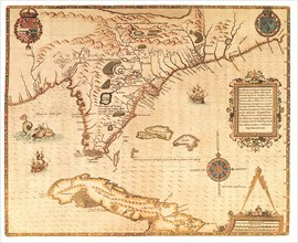
UMG22A69_251
Americae pars, Nune Virginia dicta.
UMG22A69_257
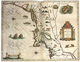
Nova Belgica et Anglia Nova.
UMG22A69_264
A Map of the most Inhabited part of Virginia.
UMG22A67_399
Head of the World.
UMG22A69_242
The Maggiolo Map.
UMG22A69_256
America noviter delineata.
UMG22A69_265
Carte reduite du Golphe de Mexique et des isles.
UMG22A69_255
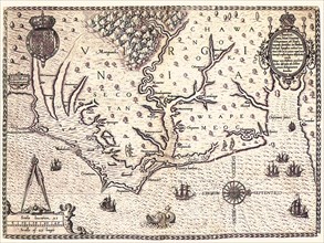
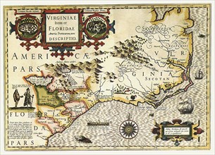
Virginiae Item et Floridae Americae Provinciarum n...
UMG22A69_266
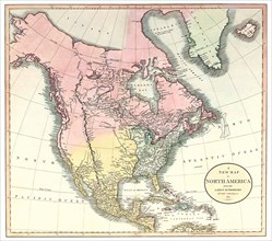
A New Map of North America.
UMG22A69_254
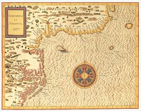
Norumbega et Virginia.
UMG22A69_267
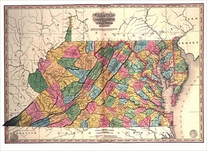
Virginia, Maryland and Delaware.
UMG22A65_277
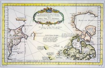
Polar Map 1702
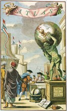
UMG22A65_444
Atlas on Frontispiece
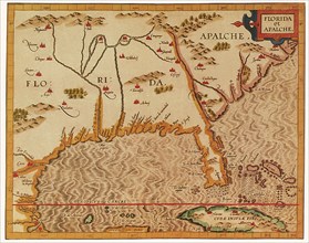
UMG22A69_253
Florida et Apalche.
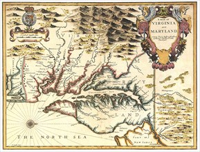
UMG22A69_260
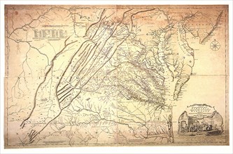
A Map of Virginia and Maryland.
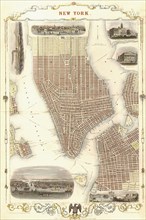
UMG22A69_271
New York 1851.
UMG22A69_252
Floridae Americanae Provinciae Recens & exactissim...
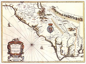
UMG22A69_261
A New description of Carolina.
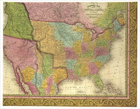
UMG22A69_270
A General Map of the United States.
UMG22A69_262
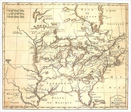
Le Cours du Fleuve Missisippi.
UMG22A69_250
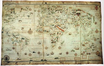
Tabu Nova Orbis.
UMG22A69_263
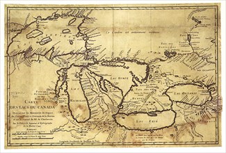
Carte des Lacs du Canada dressee sur les Manuscrit...
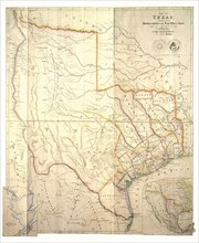
UMG22A69_272
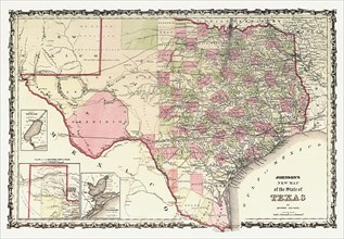
Johnson's New Map of the State of Texas.
UMG22A65_274
Old World Irish Map 1600
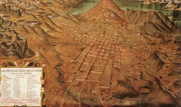
UMG22A65_278
Map of Potosi, Peru 1758
UMG22A69_268
Map of Texas.
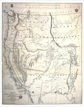
UMG22A69_269
Map of Oregon and Upper California.
UMG22A69_297
Plan of Athens.
UMG22A69_166
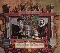
Mapmakers Gerard Mercator & Jodocus Hondius.
UMG22A69_259
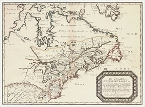
Le Canada,ou Nouvelle France.
UMG22A69_165
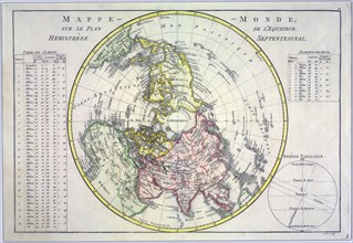
Map of the World.
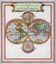
UMG22A69_258
Amerca Septentrionalis.
UMG22A55_423
Propaganda Posters
UMG22A55_424
Propaganda Posters
UMG22A60_101
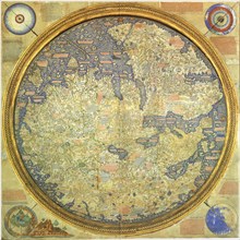
Fra Mauro Map
UMG22A56_124
Géographie
UMG22A54_027
Géographie
UMG22A55_075
Géographie
UMG22A54_340
Géographie
UMG22A55_074
Géographie

UMG22A52_056
The Future is our Life

UMG22A51_122
Hamburg - Habana - Sudstaaten
UMG22A48_401
Cartoon Map of the Current World Situation
UMG22A24_492
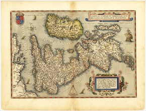
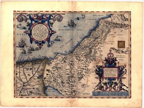
Abraham Ortelius - First World Atlas ca. 1570 - Ze...
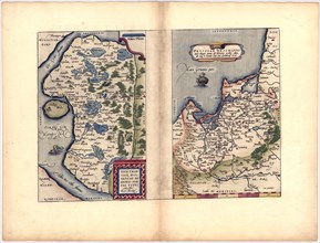
UMG22A24_493
Abraham Ortelius - First World Atlas ca. 1570 - Th...
UMG22A24_494
Abraham Ortelius - First World Atlas ca. 1570 - Fr...
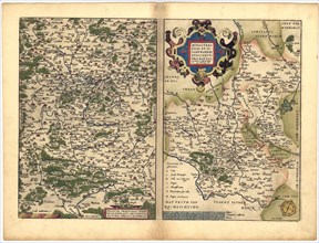
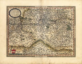
UMG22A32_143
Abraham Ortelius - First World Atlas ca. 1570 - An...
UMG22A24_485
Abraham Ortelius - First World Atlas ca. 1570 - Th...
UMG22A24_495
Abraham Ortelius - First World Atlas ca. 1570 - Av...
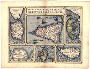
UMG22A32_142
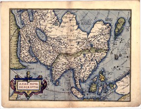
Abraham Ortelius - First World Atlas ca. 1570 - As...
UMG22A24_488
Abraham Ortelius - First World Atlas ca. 1570 - Bi...
UMG22A24_500
Abraham Ortelius - First World Atlas ca. 1570 - Rv...
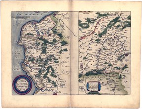
UMG22A32_145
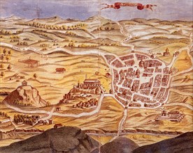
Abraham Ortelius - First World Atlas ca. 1570 - Ga...
UMG22A24_489
Abraham Ortelius - First World Atlas ca. 1570 - Ca...
UMG22A24_499
Abraham Ortelius - First World Atlas ca. 1570 - Si...
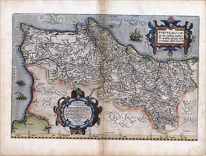
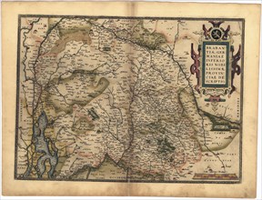
UMG22A32_144
Abraham Ortelius - First World Atlas ca. 1570 - Po...
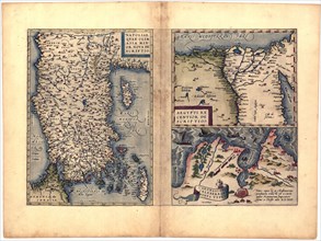
UMG22A24_490
Abraham Ortelius - First World Atlas ca. 1570 - Ge...
UMG22A25_002
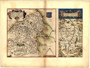
Abraham Ortelius - First World Atlas ca. 1570 - Na...
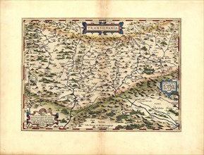
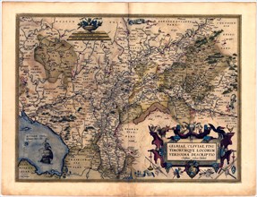
UMG22A32_147
Abraham Ortelius - First World Atlas ca. 1570 - Tr...
UMG22A24_491
Abraham Ortelius - First World Atlas ca. 1570 - Br...
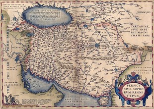
UMG22A25_001
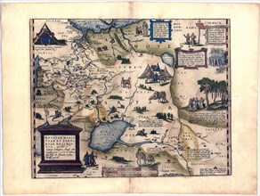
Abraham Ortelius - First World Atlas ca. 1570 - Pe...
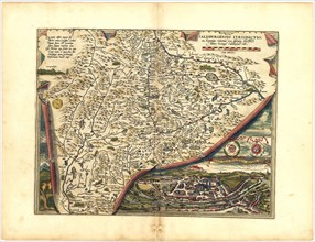
UMG22A32_146
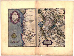
Abraham Ortelius - First World Atlas ca. 1570 - Sa...
UMG22A32_149
Abraham Ortelius - First World Atlas ca. 1570 - Pa...
- Page
-
- sur
- 5