93 results for: world map
- Page
-
- of
- 1
Please sign in for more results
ARP15A02_097
Global Positioning System
ARP15A02_113
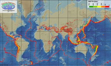
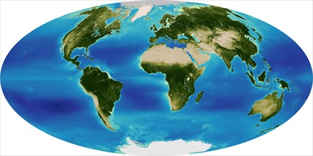
The Sea-viewing Wide Field-of-view-Sensor
ARP24A00_432
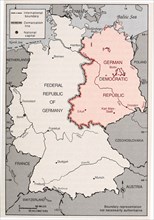
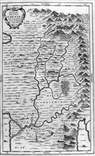
Map of Germany's Post-World War II boundaries
ARP24A00_410
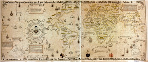
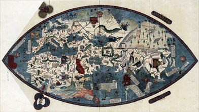
Genoese world map, 1457
ARP24A01_032
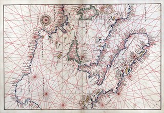
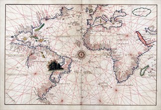
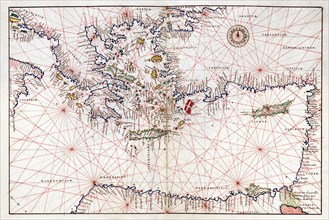
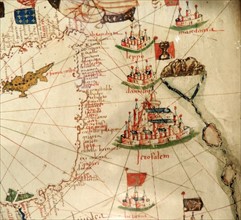
Portolan atlas of nine charts and a world map, etc...
ARP24A01_409
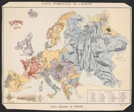
Map of the European states during World War One
ARP24A00_409
Genoese world map, 1457
ARP24A00_382
Portolan atlas of 9 charts and a world map, etc. D...

ARP24A01_167
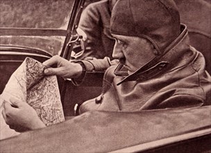
German officers viewing a map of Europe during Wor...
ARP24A00_408
Genoese world map, 1457
ARP24A01_017
Portolan atlas of nine charts and a world map, etc...
ARP24A00_387
Portolan atlas of 9 charts and a world map, etc. D...
ARP24A01_023
Portolan atlas of nine charts and a world map, etc...
ARP23A10_113
Illustration showing a map of the garden of Eden, ...
ARP23A10_123
World map showing land formations and continents a...
ARP23A17_417
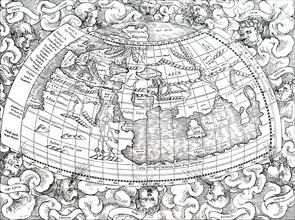
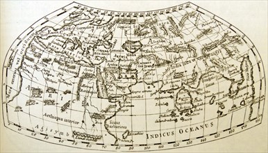
Ptolemy of Alexandria's map of the then known worl...
ARP23A15_110
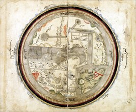
Medieval 10th century World map by Abu Ishaq Ibrah...
ARP23A11_106
Photograph of Adolf Hitler
ARP18A03_258
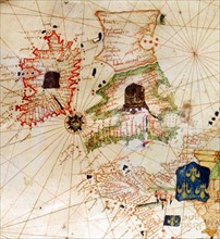
England and Ireland depicted in Jacopo Russo Map o...
ARP18A03_269
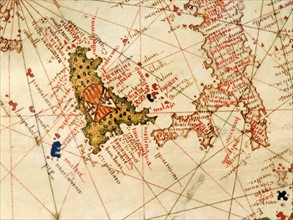
Italy and Sicily depicted in Jacopo Russo Map of t...
ARP18A05_093
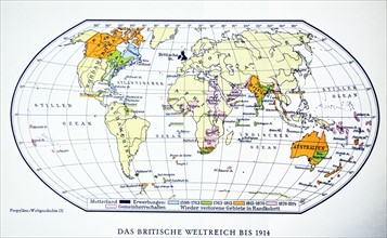
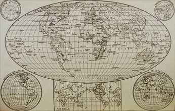
British world map 1914. WWI.
ARP18A07_375
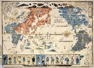
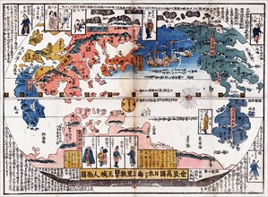
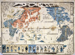
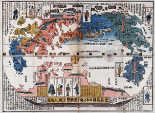
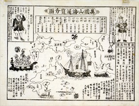
Bankoku jinbutsu no zu (People of many nations)
ARP18A28_339
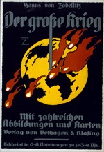
Poster is an advertisement for The Great War by Ha...
ARP18A03_270
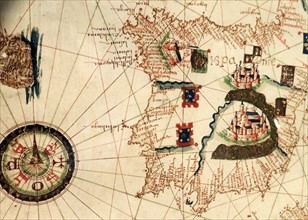
Spain and Portugal depicted in Jacopo Russo Map of...
ARP18A07_420
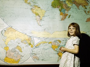
School Girl
ARP18A27_078
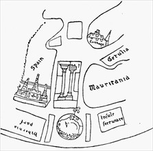
The Pillars of Hercules, as shown in a mediaeval m...
ARP18A27_095
The world as known at the end of the 15th century
ARP18A03_259
France depicted in Jacopo Russo Map of the world 1...
ARP18A09_025
Japanese diptych print
ARP18A29_166
Colour Japanese diptych print showing a map of the...
ARP18A03_262
Palestine with Jerusalem and Damascus
ARP18A27_202
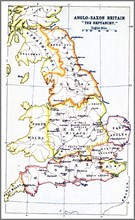
Map showing the Heptarchy of Britain
ARP18A25_026
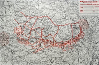
Map depicting the German advance into France after...
ARP18A03_261
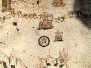
Mediterranean Sea with compass and ship
ARP18A08_053
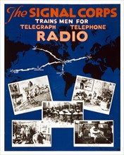
U.S. Army Signal Corps recruiting poster
ARP18A27_079
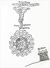
Jerusalem, the centre of the world.
ARP18A16_413
16th Century Map of the World
ARP18A27_114
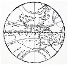
The world as known after the circumnavigation by S...
ARP18A03_263
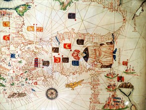
Ottoman Sultan and Turkey depicted in Jacopo Russo
ARP18A27_080
The coast of Africa, after Ptolemy (Mercator's edi...
ARP18A03_265
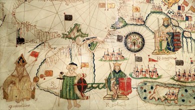
King of Hungary depicted in Jacopo Russo Map of th...
ARP18A10_120
An early map of the world
ARP18A27_107
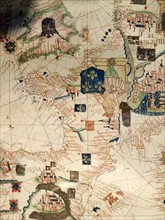
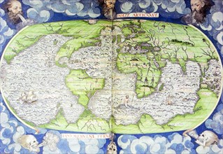
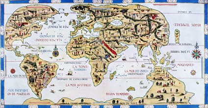
The 'Dauphin' map by Desceliers, 1546,
ARP18A27_111
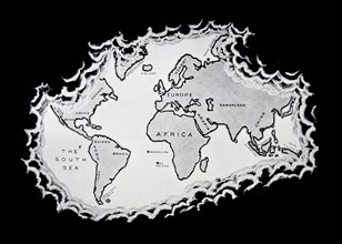
The Silver map of the world.
ARP18A27_112
The Silver map of the world.
ARP18A02_324
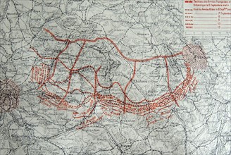
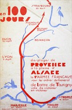
Map showing the progressive positions the French a...
ARP18A29_204
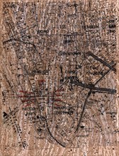
Street map showing the Ground Zero area of Lower M...
ARP18A28_360
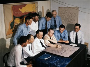
a military briefing in teh USA during World war tw...
ARP18A07_385
map of the world with an American & Russian ship o...
ARP18A07_055
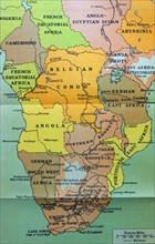
Map of central and Southern Africa in 1914
ARP18A27_105
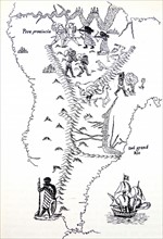
Peru and South America.
ARP15A01_183
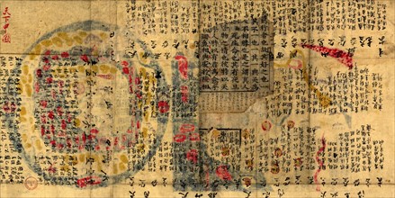
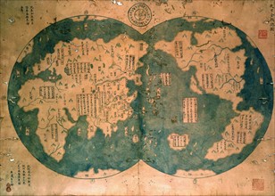
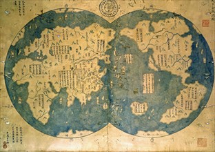
Chinese map of the world dated 1763
ARP15A01_397
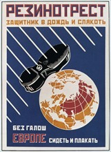
Advertisement for rubber soles on shoes
ARP15A01_184
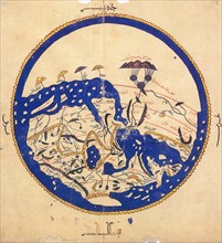
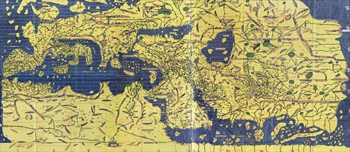
World map by the Arab geographer Muhammad al-Idris...
ARP17A37_171
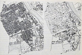
Map showing the central parts of Warsaw
ARP17A22_289
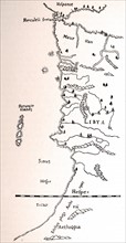
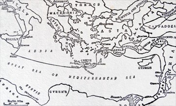
Sketch map to illustrate Saint Paul's Journeys
ARP17A25_202
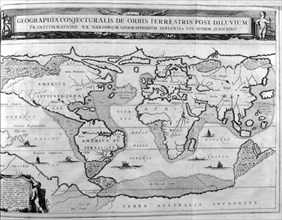
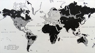
Map depicting the Europeanisation of the World
ARP17A25_072
Illustration from Harmsworth History of the World
ARP17A25_214
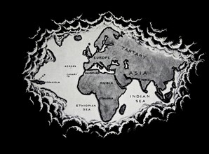
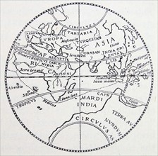
Early Geographers' idea of the world
ARP17A24_485
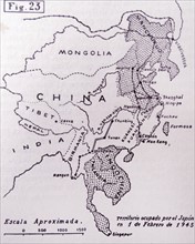
Japanese occupied territory during 1945
ARP17A25_182
The World as Known on the Eve of the Discovery of ...
ARP17A25_209
Modern representation of the world shown on three ...
ARP17A25_069
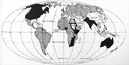
Map showing the expansion of the white races throu...
ARP17A25_159
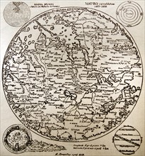
Fra Mauro map
ARP17A26_453
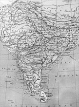
Map of India
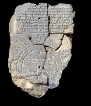
ARP17A18_161
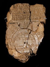
Clay tablet depicting a Babylonian map of the Worl...
ARP17A14_161
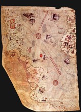
Surviving fragment of the first World Map of Piri ...

ARP17A13_262
Detroit Federal Theatre Units 'It can't happen her...
ARP17A10_293
The Millennium Chapel, Coventry Cathedral, England...

ARP17A12_477
Anti-German and anti-Japanese World War Two propag...
ARP15A06_496
Map showing the victorious World War Two, route of...
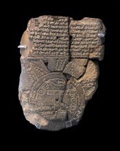
ARP11A03_024
A unique ancient map of the Mesopotamian world
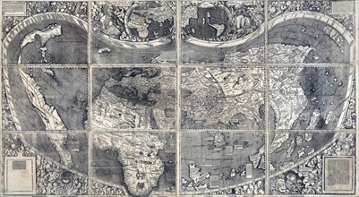
ARP11A05_102
Martin Waldesmüller was the first cartographer to ...
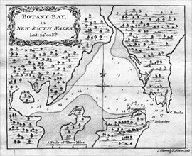
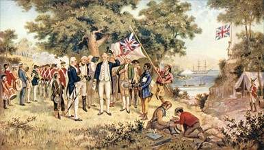
ARP11A04_362
Botany Bay
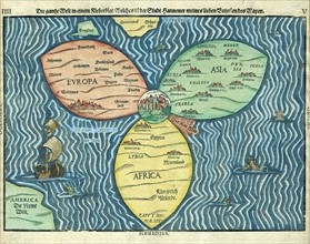
ARP11A05_103
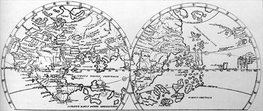
This “cloverleaf” map of the world
ARP11A01_037
World map, 14th century
ARP11A01_013
The Tabula Rogeriana
ARP11A00_399
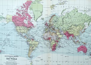
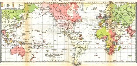
Map of the British Empire 19th Century
ARP11A00_026
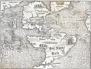
Map of the New World by Sebastian Munster
ARP10A03_309
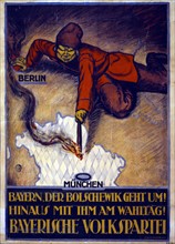
Bolshevik leaning across map of Europe

ARP10A03_434
World War II : australian poster
ARP10A04_106
World Flat projection map
ARP10A03_452
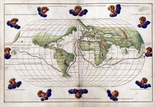
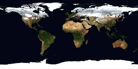
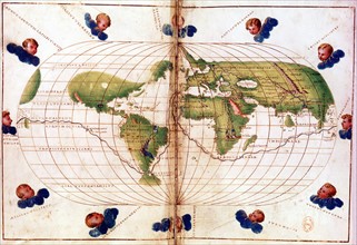
World map
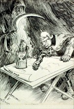
ARP10A01_481
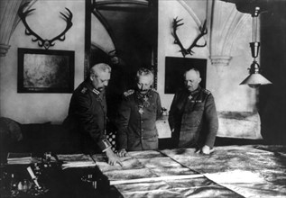
Wilhelm II of Germany studying maps General Hinden...
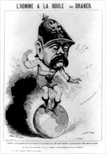
ARP10A02_137
The Man on the Ball
ARP10A02_072
Babylonian world map
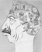
ARP10A02_205
Phrenological map of the German Kaiser's brain
ARP10A03_002
Allen Rogers, Wilhelm II Emperor of Germany
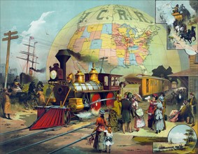
ARP10A01_436
Train in station on Illinois Central Railroad
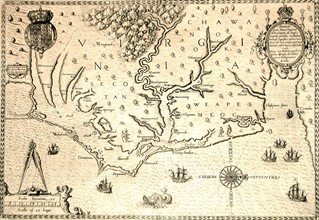
ARP10A02_146
Map of 1590 engraved by Theodore de Bry
ARP07102_390005841
James Cook
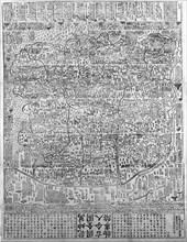
ARP07099_390003463
Chinese World Map
ARP07098_390003130