2196 résultats pour : cartography history
- Page
-
- sur
- 22
Connectez-vous pour plus de résultats
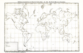
UMG25A06_183
This geographical and historical outline map shows...
UMG25A06_181
This geogrpahical and historical outline maps show...
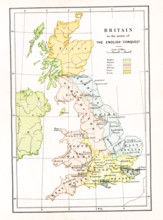
UMG25A05_103
This map shows Britain at the time when it was in ...
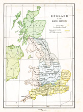
UMG25A05_104
This map shows Britain in the 9th century A.D. The...
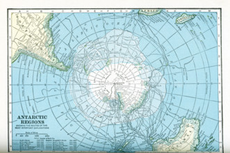
UMG25A05_450
This map dates to the 1920s and shows the Antarcti...
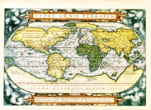
UMG25A06_184
The text at the top of this world map by Abraham O...
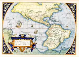
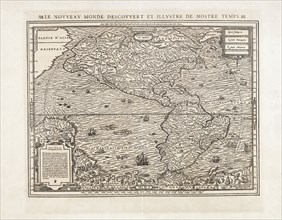
UMG25A06_179
Abraham Ortelius's map of the Americas, Americae s...
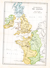
UMG25A05_102
This map shows the dominions of the Angevins in Br...
UMG25A06_180
This geographical and historical outline map shows...
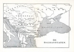
UMG25A05_137
This map shows the Balkan States in 1921. The map ...
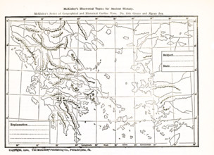
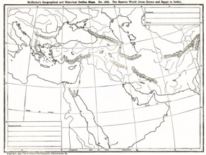
UMG25A06_182
This geographical and historical outline map focus...
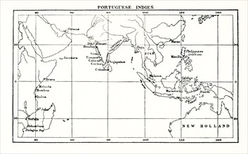
UMG25A01_169
This map shows the Portuguese exploits in the Indi...
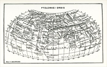
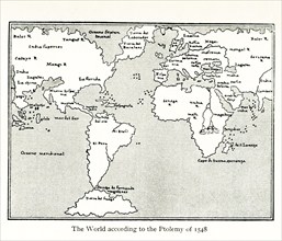
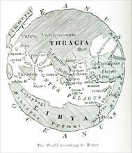
UMG25A01_164
This map shows the world according to Ptolemy. The...
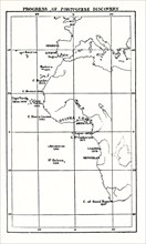
UMG25A01_168
This map shows the progress of Portuguese discover...
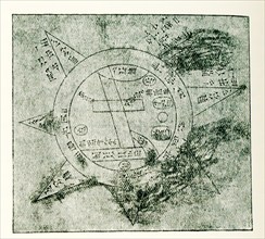
UMG25A01_182
This Babylonian/Chaldaean map of the world was dra...
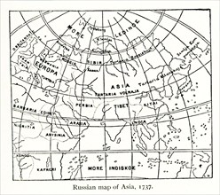
UMG25A01_161
This Russian map shows how they pictured Asia in ...
UMG25A01_160
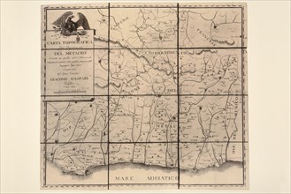
This map by Giacomo Gastaldi (c 1500 – c 1565) was...
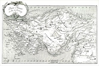
UMG25A01_204
This 1903 illustration shows a map of Asia Minor (...
UMG25A01_210
This map, which dates to 1903, delineates the anci...
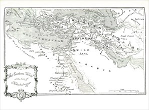
UMG25A01_202
This 1903 illustration shows a map of the eastern ...
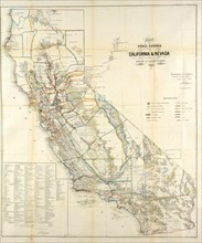
UMG24A16_123
California Resources Map In 1866
UMG24A07_006
This illustration dates to 1912 and is part of a s...
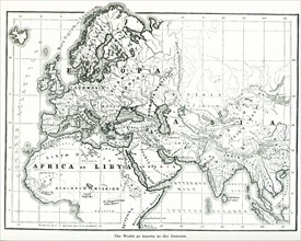
UMG24A06_490
This map shows the world as it was known to the an...
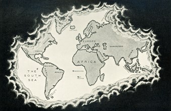
UMG24A06_489
This image shows a map of the world ""according to...
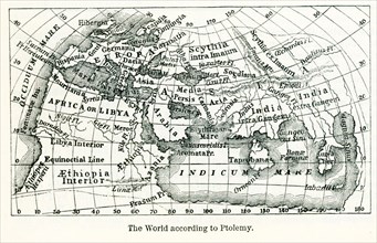
UMG24A06_491
Pictured here is the world according to Ptolemy, a...
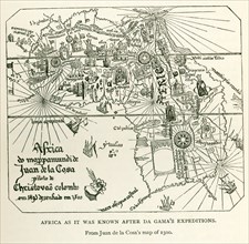
UMG24A06_497
This image shows Africa as it was known after DaGa...
UMG24A07_005
This illustration dates to 1912 and is part of a s...
UMG24A07_010
This illustration dates to 1912 and is part of a s...
UMG24A04_262
European Turkey map by Thunot Duvotenay. Historia ...
UMG24A04_273
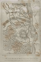
Holy Roman Empire. Plan of the Battle of Vienna, 1...
UMG24A04_265
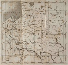
General map of Poland. Engraved by Lemaitre. Histo...
UMG23A66_397
Carte géographique du 17e siècle
UMG23A66_398
Carte géographique du 16e siècle
UMG23A66_399
Carte géographique du 16e siècle
UMG23A66_391
Carte géographique du 17e siècle
UMG23A66_393
Carte géographique du 17e siècle

UMG23A66_392
Carte géographique du 17e siècle
UMG23A66_394
Carte géographique du 17e siècle
UMG23A66_395
Carte géographique du 17e siècle
UMG23A66_396
Carte géographique du 17e siècle
UMG23A66_387
Carte géographique du 19e siècle
UMG23A66_388
Carte géographique du 17e siècle
UMG23A66_389
Carte géographique du 17e siècle
UMG23A66_390
Carte géographique du 17e siècle
UMG23A66_384
Carte géographique du 18e siècle
UMG23A66_385
Carte géographique du 18e siècle
UMG23A66_386
Carte géographique du 19e siècle
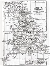
UMG23A58_459
Map of Roman Britain showing the area of the islan...
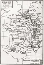
UMG23A58_421
Map of France.
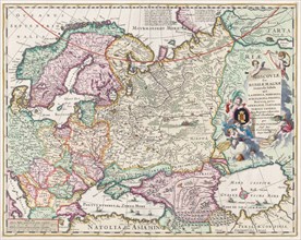
UMG23A60_343
17th century map of Russia and surrounding countri...
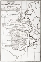
UMG23A58_376
Map of France by the Treaty of Bretigny.
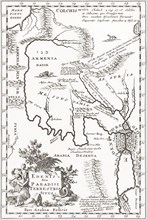
UMG23A62_060
Imagined situation of the Garden of Eden.
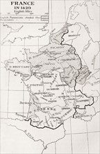
UMG23A58_420
Map of France in 1429.
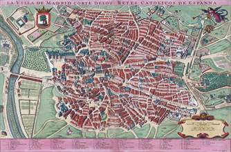
UMG23A61_201
Anonymous map of Madrid dating from late 17th or e...
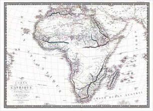
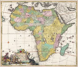
UMG23A60_090
Map of the African continent by the geographer A.H...
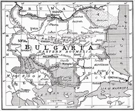
UMG23A58_373
Map of Bulgaria at the outbreak of WWI.
UMG23A62_099
The true and exact Plan of all the Old and New For...

UMG23A61_117
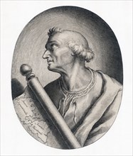
Amerigo Vespucci.
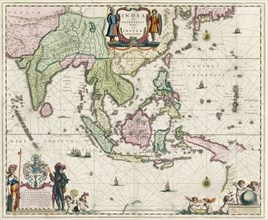
UMG23A61_155
Map of South-East Asia.
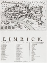
UMG23A62_069
Map of Limerick.
UMG23A60_344
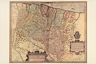
Map of Africa dating from the late 17th century.

UMG23A62_481
Nathaniel Nye.
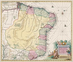
UMG23A61_133
Map of Brazil.
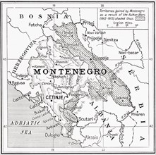
UMG23A58_371
Map of Montenegro at the outbreak of WWI.
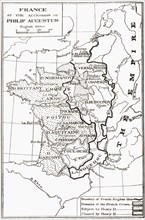
UMG23A58_414
Map of France at the accession of Philip II, aka P...
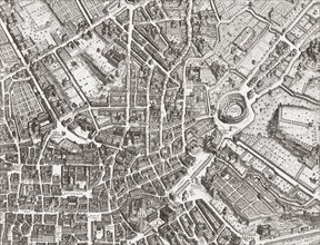
UMG23A61_153
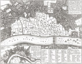
Map of the centre of Rome.
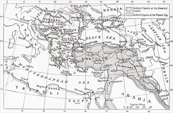
UMG23A58_312
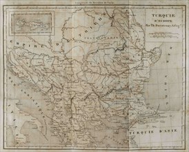
Map of Turkey at the outbreak of WWI.
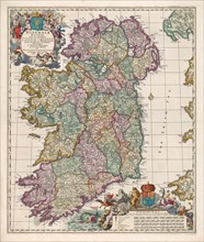
UMG23A62_474
Map of Ireland.
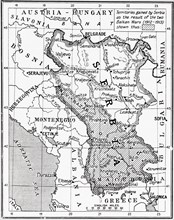
UMG23A58_351
Map of Serbia at the start of WWI.
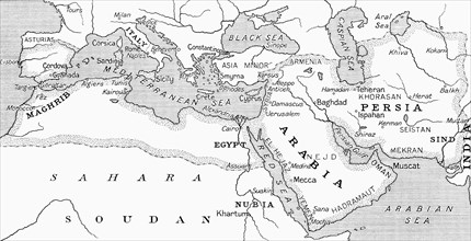
UMG23A58_328
Map of the Umayyad Caliphate at its height around ...
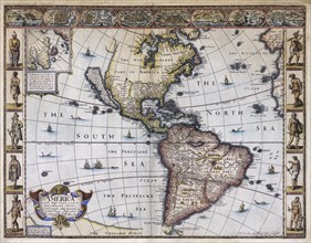
UMG23A63_006
Map of America.
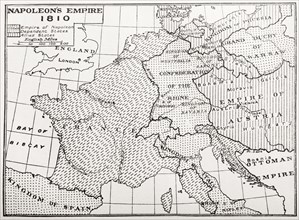
UMG23A58_429
Map showing Napoleon's Empire, France.
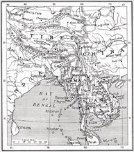
UMG23A58_437
Map of the Indo-Chinese nations as at 1915.
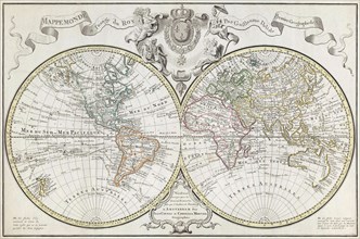
UMG23A61_164
World Map.
UMG23A62_478
Map of North and South America.
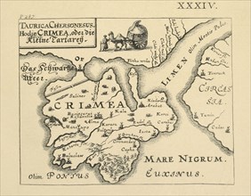
UMG23A58_290
Map of Crimea published in Kiev.
UMG23A61_124
Amerigo Vespucci.
UMG23A62_062
Map showing the extent of the damage caused by the...
UMG23A65_099
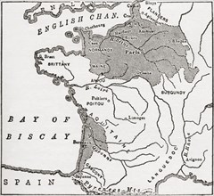
Map showing French territory held by the English w...
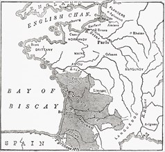
UMG23A65_098
Map Showing The English Dominions In France At The...
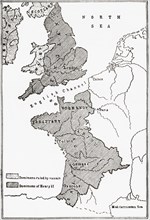
UMG23A65_097
Map showing the French dominions of Henry II.
UMG23A64_269
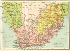
Map Of South Africa Since 1815.
UMG23A65_096
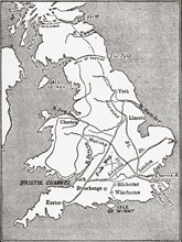
Map showing the Roman roads in Britain.
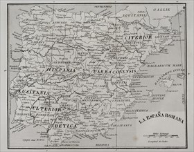
UMG23A44_360
Map of Roman Hispania.
UMG23A44_402
Palma de Mallorca map.

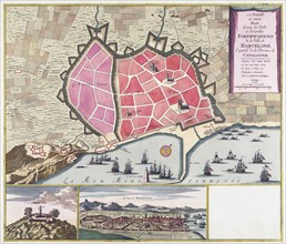
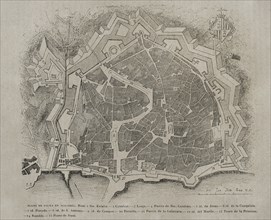
UMG23A44_348
Map of the city of Tarragona.
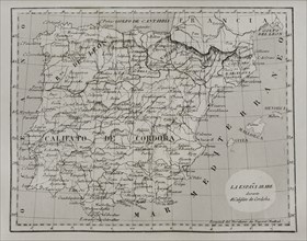
UMG23A44_375
Map of Moorish Spain during the Caliphate of Cordo...
UMG23A16_379
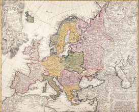
Europe map, 1793
UMG23A00_243
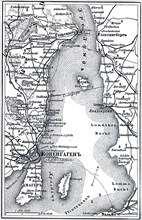
Map of Copenhagen.
UMG23A00_465
Plan of Krakow.
UMG23A02_037
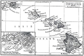
Map of Archipelago Hawaii.
UMG23A02_072
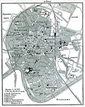
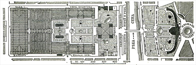
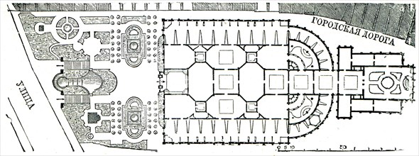
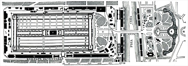
Paris Exhibition.
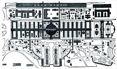
UMG23A02_073
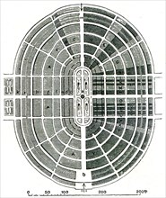
Vienna Exhibition.
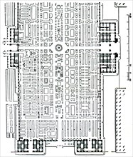
UMG23A02_038
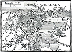
Plan of La Habana.
UMG23A02_039
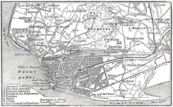
Plan of Le Havre.
UMG23A02_068
Berlin Exhibition.
UMG23A02_069
Paris Exhibition.
UMG23A02_070
Paris Exhibition.
UMG23A02_071
Paris Exhibition.
UMG23A02_064
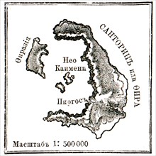
Map of Santorini islans before erasure of 1880.
- Page
-
- sur
- 22