1751 résultats pour : map-
- Page
-
- sur
- 18
Connectez-vous pour plus de résultats
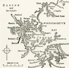
UMG25A05_408
This map dates to 1922 and shows Boston and its vi...
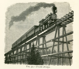
UMG25A05_353
This illustration dates to the 1870s and shows a t...
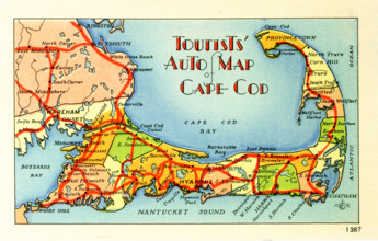
UMG25A06_238
Tourists' Auto Map of Cape Cod.
UMG25A06_183
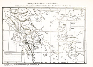
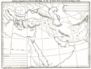
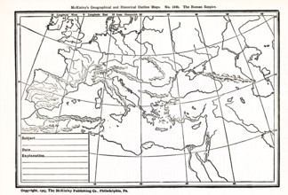
This geographical and historical outline map shows...
UMG25A06_170
This map dating to late 1800s shows Vicksburg and ...
UMG25A06_171
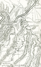
Shown here is a map of the Chickamauga and Chatta...
UMG25A06_181
This geogrpahical and historical outline maps show...
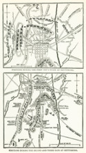
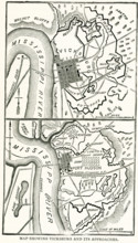
UMG25A06_168
The Battle of Gettysburg was fought July 1-3, 1863...
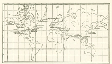
UMG25A05_438
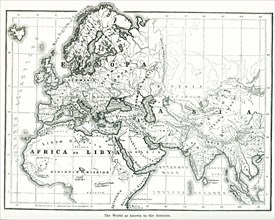
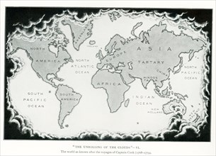
The image dates to the early 1920s. Around the wor...
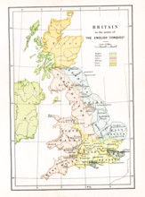
UMG25A05_103
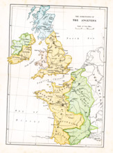
This map shows Britain at the time when it was in ...
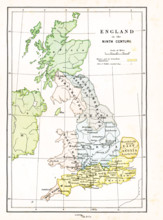
UMG25A05_104
This map shows Britain in the 9th century A.D. The...
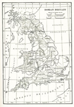
UMG25A06_054
Map Roman Britain. The Province of Britain (Britan...
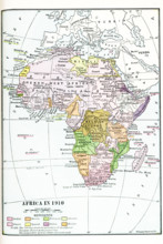
UMG25A06_052
Map of Africa in 1910. Note: The coloring shows t...
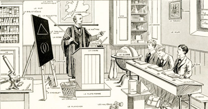
UMG25A06_043
French Lesson in Pictures - The names of familiar ...
UMG25A06_053
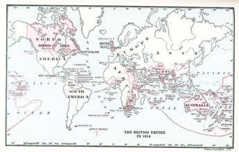
Map of British Empire in 1914.
UMG25A06_055
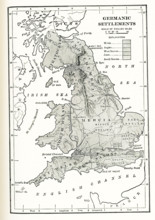
Germanic Settlements in England. This map shows Ge...
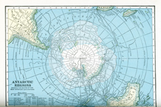
UMG25A05_450
This map dates to the 1920s and shows the Antarcti...
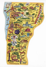
UMG25A06_186
This Vermont-state-shaped postcard dates to 1948.
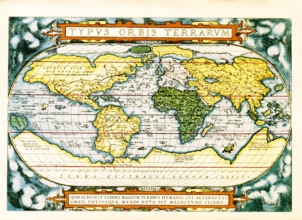
UMG25A06_184
The text at the top of this world map by Abraham O...
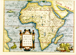
UMG25A06_178
Map of Africa - the inset in lower left titles it:...
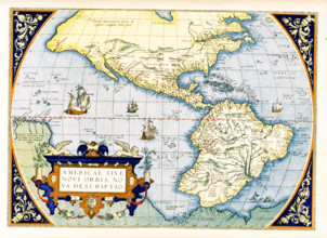
UMG25A06_179
Abraham Ortelius's map of the Americas, Americae s...
UMG25A05_102
This map shows the dominions of the Angevins in Br...
UMG25A06_180
This geographical and historical outline map shows...
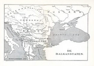
UMG25A05_137
This map shows the Balkan States in 1921. The map ...
UMG25A06_182
This geographical and historical outline map focus...
UMG25A06_056
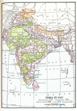
India in 1857. British dominions are in pink. Prot...
UMG25A01_165
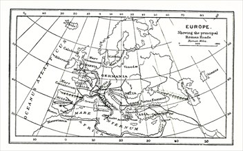
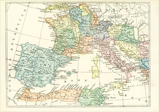
This map of europe shows the principal ancient Rom...
UMG25A01_169
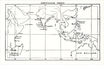
This map shows the Portuguese exploits in the Indi...
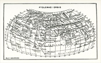
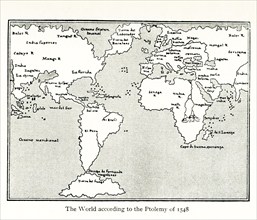
UMG25A01_164
This map shows the world according to Ptolemy. The...
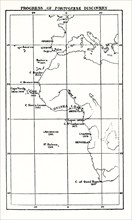
UMG25A01_168
This map shows the progress of Portuguese discover...
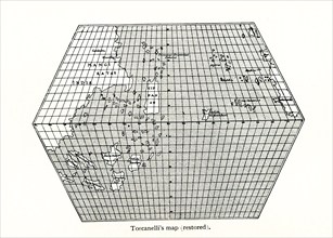
UMG25A01_156
Toscanelli’s Map (Restored). Toscanelli (1397 –14...
UMG25A01_182
This Babylonian/Chaldaean map of the world was dra...
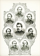
UMG25A01_402
American civil war, us civil war, Charleston harbo...
UMG25A01_157
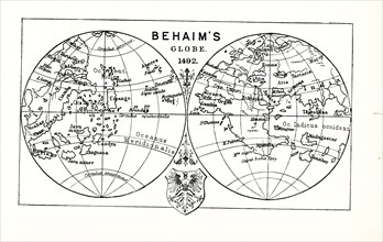
This illustration shows Behaim's globe in 1492. Ma...
UMG25A01_161
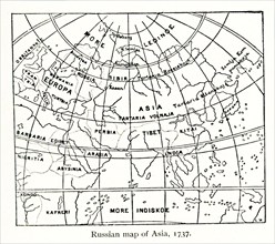
This Russian map shows how they pictured Asia in ...

UMG25A01_162
This map shows the exploration and partition of Af...
UMG25A01_401
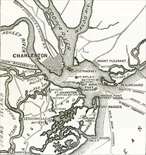
Two forts stand at the entrance of Charleston Harb...
UMG25A01_160
This map by Giacomo Gastaldi (c 1500 – c 1565) was...

UMG25A00_275
Treaty of Campo Formio. Signed on 17 October 1797 ...
UMG25A00_453
On June 17, 1775, early in the Revolutionary War (...
UMG25A01_204
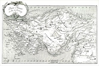
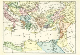
This 1903 illustration shows a map of Asia Minor (...
UMG25A01_210
This map, which dates to 1903, delineates the anci...
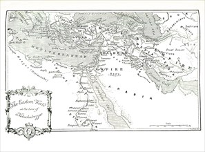
UMG25A01_202
This 1903 illustration shows a map of the eastern ...
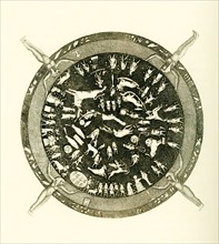
UMG25A01_177
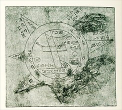
Carved into the ceiling of the portico of a chapel...
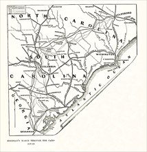
UMG24A35_117
Sherman’s March Through Carolinas. This map shows:...
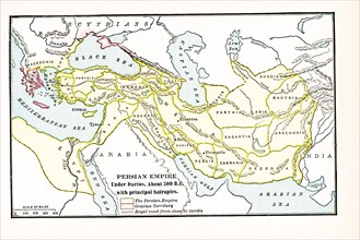
UMG24A35_058
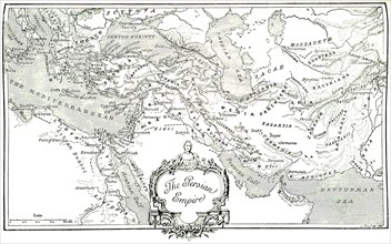
Persian Empire under Darius about 500 BC. with pri...
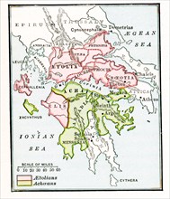
UMG24A35_061
This map shows The Aetolian and Achaean Leagues ab...
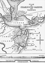
UMG24A35_098
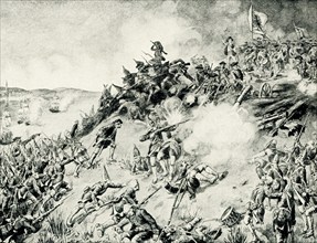
Charleston Harbor 1861
UMG24A34_387
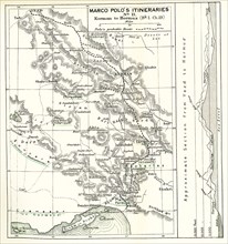
The caption for this map from The Travels of Marco...
UMG24A35_062
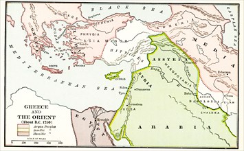
Greece and the Orient about B.C. 1250. The legend ...
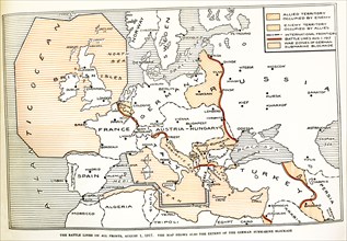
UMG24A35_123
Battle lines on all fronts August 1, 1917. The map...
UMG24A34_384
The caption for this map from The Travels of Marco...
UMG24A16_123
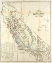
California Resources Map In 1866
UMG24A07_006
This illustration dates to 1912 and is part of a s...
UMG24A06_482
This ground plan of Roman catacombs dates to 1897....
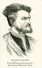
UMG24A07_002
This illustration of Jacques Cartier dates to 1912...
UMG24A06_490
This map shows the world as it was known to the an...
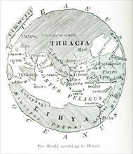
UMG24A06_489
This image shows a map of the world ""according to...
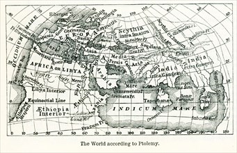
UMG24A06_491
Pictured here is the world according to Ptolemy, a...
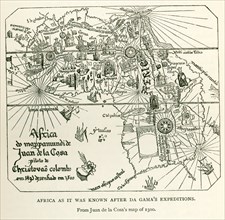
UMG24A06_497
This image shows Africa as it was known after DaGa...
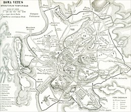
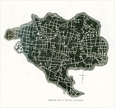
UMG24A06_477
This map of Rome shows the city during the period ...
UMG24A07_005
This illustration dates to 1912 and is part of a s...
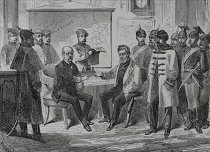
UMG24A05_153
Napoleon III (Louis Napoleon Bonaparte) (1808-1873...
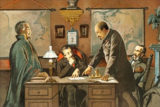
UMG24A05_318
Franco-Prussian War (1870-1871). Armistice ceremon...
UMG24A07_010
This illustration dates to 1912 and is part of a s...
UMG24A06_475
This map dates to 1897 and shows the western Provi...
UMG24A06_476
This map dates to 1897 and shows the western Provi...
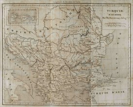
UMG24A04_262
European Turkey map by Thunot Duvotenay. Historia ...
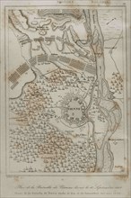
UMG24A04_273
Holy Roman Empire. Plan of the Battle of Vienna, 1...
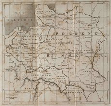
UMG24A04_265
General map of Poland. Engraved by Lemaitre. Histo...
UMG24A04_275
Partitions of Poland. The First Partition of Polan...

UMG24A03_284
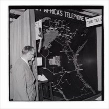
Royal Show East Africa Post and Telecommunications...
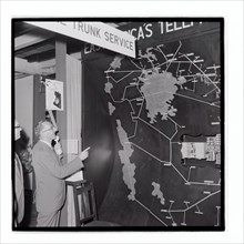
UMG24A03_285
Royal Show East Africa Post and Telecommunications...
UMG24A03_286
Royal Show East Africa Post and Telecommunications...

UMG24A03_302
Royal Show Settlement Board Stand

UMG24A03_362
Royal Show Nyali Estate Stand

UMG24A03_383
Royal Show East Africa Post and Telecommunications...

UMG24A03_301
Royal Show Settlement Board Stand
UMG24A01_243
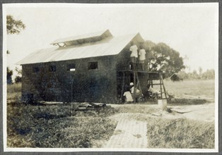
Nairobi P.W.D apprentices with map cabinet
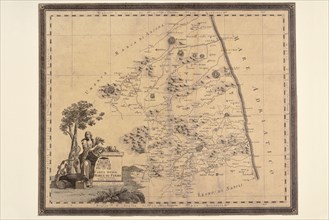
UMG23A66_397
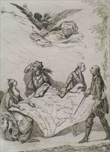
Carte géographique du 17e siècle
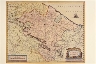
UMG23A66_398
Carte géographique du 16e siècle
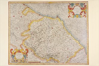
UMG23A66_399
Carte géographique du 16e siècle
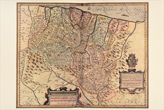
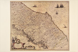
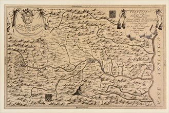
UMG23A66_391
Carte géographique du 17e siècle
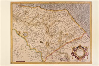
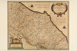
UMG23A66_393
Carte géographique du 17e siècle

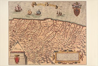
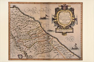
UMG23A66_392
Carte géographique du 17e siècle
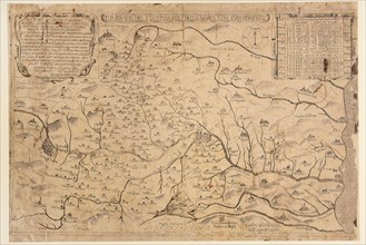
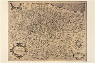
UMG23A66_394
Carte géographique du 17e siècle
UMG23A66_395
Carte géographique du 17e siècle
UMG23A66_396
Carte géographique du 17e siècle
UMG23A66_387
Carte géographique du 19e siècle
UMG23A66_388
Carte géographique du 17e siècle
UMG23A66_389
Carte géographique du 17e siècle
UMG23A66_390
Carte géographique du 17e siècle
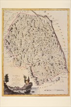
UMG23A66_384
Carte géographique du 18e siècle
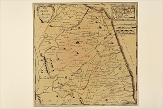
UMG23A66_385
Carte géographique du 18e siècle
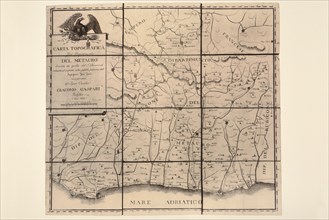
UMG23A66_386
Carte géographique du 19e siècle
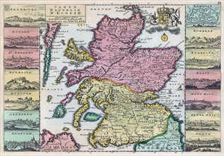
UMG23A62_310
Map of Scotland dating from the early 18th century...
UMG23A62_325
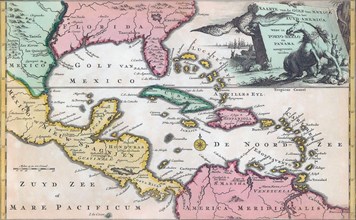
18th century map of Central America and the Gulf o...
UMG23A62_334
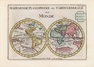
World map dating from the late 17th or early 18th ...
UMG23A58_180
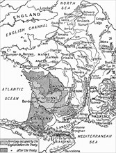
A map of France after the Treaty of Bretigny.
UMG23A58_459
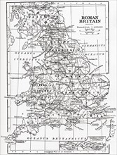
Map of Roman Britain showing the area of the islan...
- Page
-
- sur
- 18